
Cette page n'a pas encore été traduite et s'affiche en anglais.
Amakusa Five Bridges Sunset Drive
Recherche et rédaction Hinato
Préfecture de Kumamoto · Amakusa
32.6000°N, 130.4167°E
The Amakusa Pearl Line is a 17km scenic route connecting five islands via five consecutive bridges, built in 1966 to end the islands' isolation. Each bridge offers different views: Bridge 1 overlooks Kumamoto Port, Bridge 3 spans the narrowest channel, and Bridge 5 (the longest at 502m) provides open-ocean views toward the East China Sea. Driving the route at sunset creates a sequence of changing light over water and island silhouettes.
The bridges are free (toll was abolished in 2003) and have parking areas at both ends of each span for photography stops.
Informations essentielles
Horaires d'ouverture
Bridges accessible 24/7. Parking areas at each bridge 24/7.
Fermé: Open year-round
Tarif d'entrée
Bridges toll free. Bicycle rental ¥1,000/day at Misumi Port.
Meilleure saison
April–September for direct sunset light over the channel (Bridges 3–4 viewpoint); clear winter days for best sea visibility
Durée de visite
2 hours with photo stops at each bridge; 4–5 hours for full cycling route
Comment s'y rendre
Informations d'accès
Guide d'initié
Lieux à proximité
Les lieux secrets les plus proches de Amakusa Five Bridges Sunset Drive, par distance à vol d'oiseau.
 そらみみ / CC BY-SA 4.0
Misumi West Port
Well knownMisumi West Port was one of three ports the Meiji government built to modernise Japanese shipping, designed in 1887 by t…
Okoshiki Coast
Little knownThe Ariake Sea has one of the largest tidal ranges in Japan, and when it goes out at Okoshiki it leaves several kilometr…
Myoken Fireworks Festival
Little knownThe Yatsushiro Myoken Festival fireworks (October) is consistently ranked among Japan's top three fireworks competitions…
Shimabara Castle & Christian Rebellion Site
Well knownShimabara Castle (1625) stands on the site of the Shimabara Rebellion (1637–1638) — the largest armed uprising in Edo-pe…
 Barry Silver / CC BY 2.0
Unzen Jigoku (Unzen Hell)
Well knownUnzen Jigoku is a 500-meter-wide field of active volcanic vents on the slopes of Mt. Unzen, emitting sulfurous steam at…
Shimabara Spring Water Swimming Carp Streets
Well knownShimabara City's residential streets flow with crystal-clear spring water emerging from underground volcanic aquifers be…
Plus de lieux à Préfecture de Kumamoto
 Nissy-KITAQ / CC BY-SA 3.0
Taipien
Locally knownTaipien is a bowl of clear chicken and pork broth with mung bean vermicelli in it, topped with stir-fried pork, cabbage,…
 Hykw-a4 at Japanese Wikipedia / CC BY-SA 3.0
Ikinari Dango
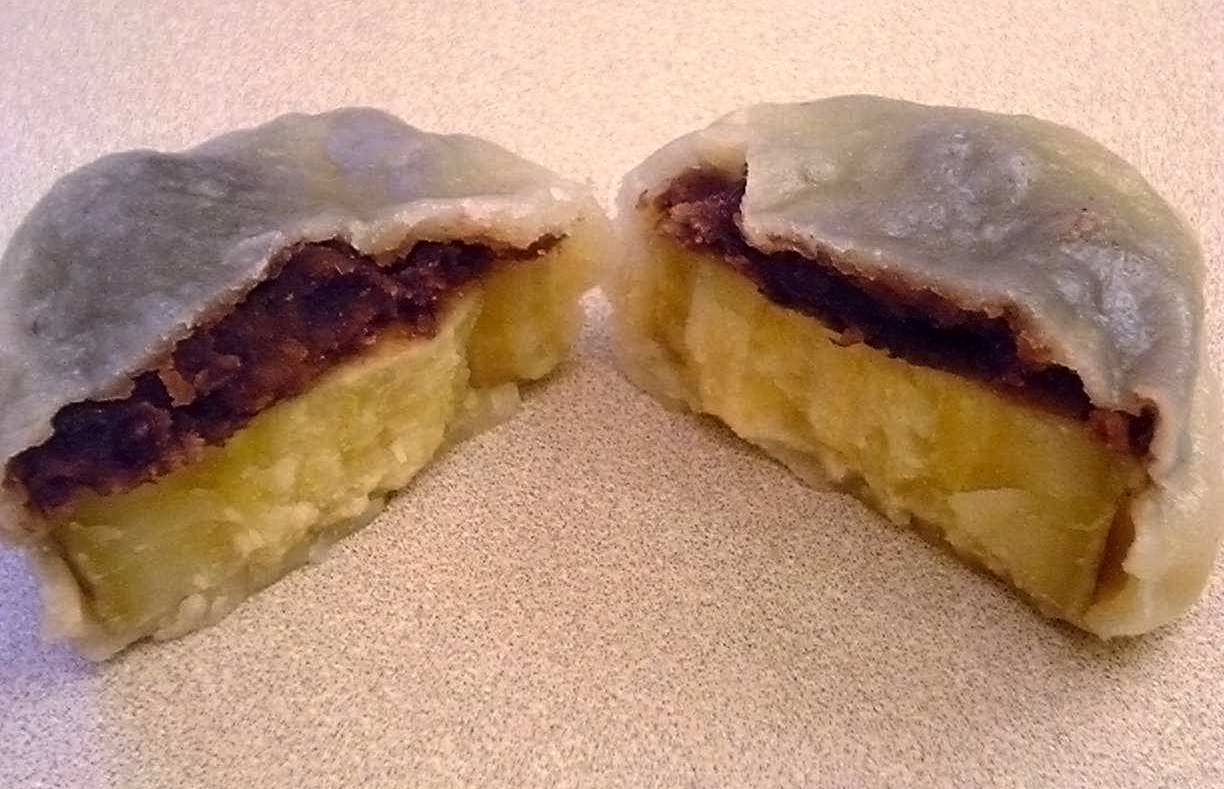
Locally knownA thick slice of raw sweet potato and a spoonful of sweet bean paste, wrapped in a plain wheat dough and steamed. That i…
Hitomoji Guruguru
Locally knownA spring onion, briefly blanched, folded in half and then wound round its own white base into a tight coil, served with…