
Cette page n'a pas encore été traduite et s'affiche en anglais.
Tsugaru-Iwaki Skyline
Recherche et rédaction Hinato
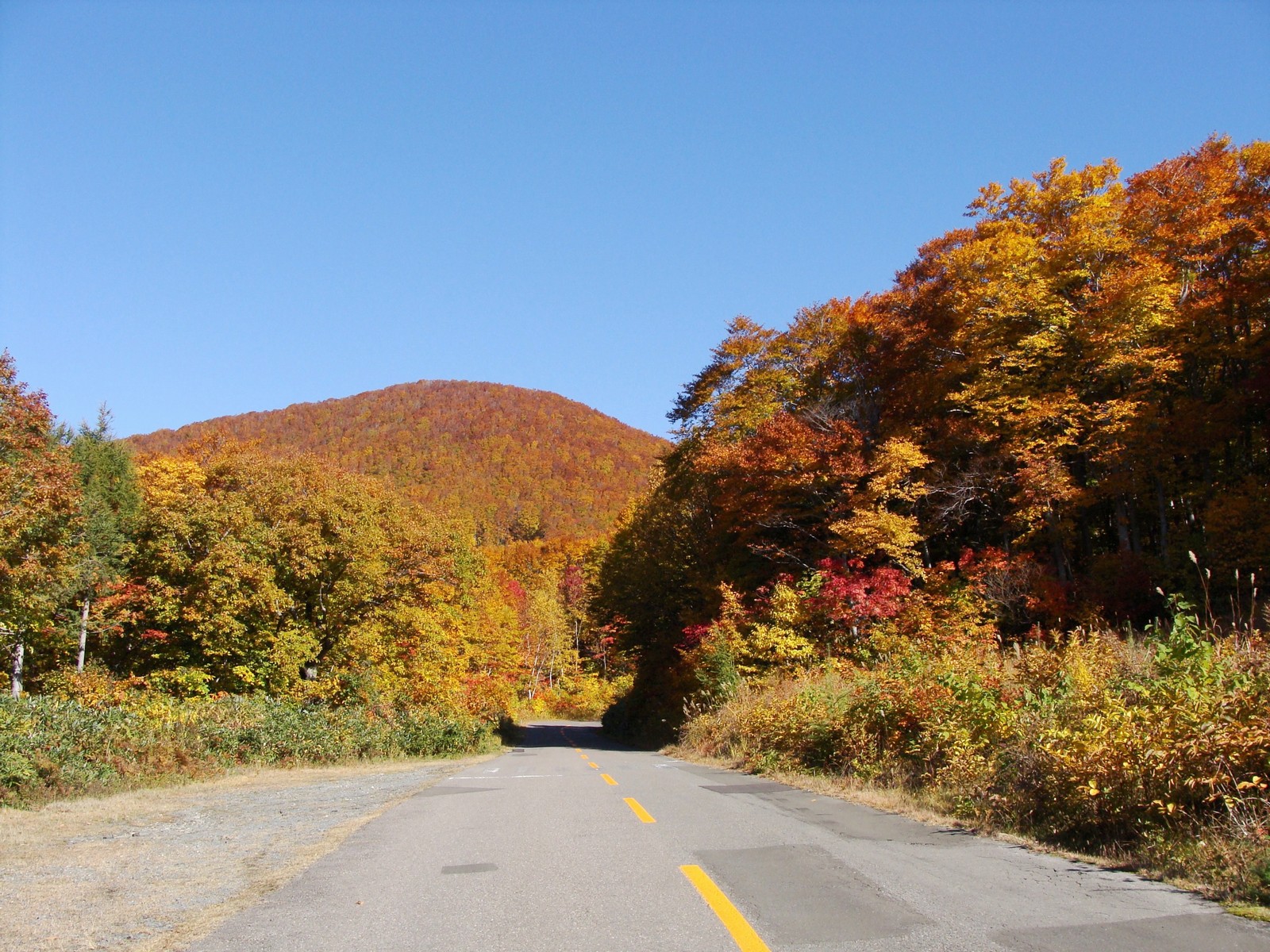
Photo: あおもりくま(aomorikuma) / Wikimedia Commons (CC BY-SA 3.0) · original
The Tsugaru-Iwaki Skyline (岩木山スカイライン) is a 9.8-kilometer toll road ascending Mt. Iwaki (岩木山, 1,625m), Aomori's most iconic peak and the highest mountain in the Tsugaru region. The winding mountain road climbs from 200 meters to 1,247 meters elevation (8th station), passing through forest zones and emerging above the treeline to panoramic views of the Tsugaru Plain, Sea of Japan, and on clear days, Hokkaido's Matsumae Peninsula across the Tsugaru Strait.
The skyline features 69 curves as it spirals up the mountain's northeast slope. Each hairpin turn reveals new perspectives — dense beech forests in lower elevations, alpine meadows mid-mountain, and volcanic rock near the summit. The 8th station parking area includes a ropeway (lift) to the 9th station (1,400m), from which a 40-minute hiking trail reaches the summit (1,625m). The summit offers 360° views of Aomori Prefecture and the Sea of Japan.
Mt. Iwaki is called 'Tsugaru Fuji' due to its conical shape resembling Mt. Fuji. The mountain is sacred in Shugendo (mountain asceticism) tradition, with Iwaki-yama Shrine at the base and Buddhist monuments along the trails. The skyline is open April-November, closing in winter due to heavy snow.
Informations essentielles
Horaires d'ouverture
8:00 AM – sunset | Open late April–early November
Fermé: Closed November–April (heavy snow)
Tarif d'entrée
Toll road: ¥2,000 standard car / ¥1,700 light car | Ropeway to 9th station: ¥1,000 round-trip | Summit hike: free
Meilleure saison
Late September–early October (clear skies and autumn colors) | Late April–May (snow contrasts)
Durée de visite
3-4 hours (drive + ropeway + optional summit hike)
Comment s'y rendre
Informations d'accès
Tsugaru-Iwaki Skyline, Hyakuzawa, Hirosaki. A drive from Hirosaki (20km southwest). Toll: ¥2,000 standard car / ¥1,700 light car, open late April-early November (closed Nov-April, snow). 8th station parking (free). Ropeway to 9th station: ¥1,000 round-trip, 10 minutes. Summit hike from 9th station: 40 minutes one-way, moderate difficulty. Bring warm layers (summit 10°C cooler than base).
Guide d'initié
Best season: Autumn (late September-early October) offers the best conditions — clear skies (higher probability than summer), cool temperatures, and lower-elevation autumn colors. Summer (July-August) can be foggy/cloudy, obscuring views. Spring (late April-May) features lingering snow at higher elevations, creating dramatic contrasts. Avoid rainy days — the drive is treacherous in rain and views are zero.
Driving experience: The skyline's 69 curves require confident driving — the road is narrow (one-way in sections), shoulders are minimal, and guardrails are sparse. Hairpin turns demand slow speeds (20-30 km/h). Motion-sensitive passengers should take motion sickness medication. Budget 30-40 minutes for the ascent (9.8km), stopping at overlooks. The descent is faster but requires careful braking (use engine braking to avoid brake overheating).
Summit hike: The ropeway delivers you to the 9th station (1,400m), from which the summit trail (岩木山山頂, 1,625m) ascends 225 meters over 40 minutes. The trail is rocky and steep but well-maintained.
Photography: The drive offers countless pull-offs for photography. Key spots: Curve 33 (panoramic Tsugaru Plain view), 8th station (Mt. Wide-angle lenses (16-35mm) capture the mountain's scale and surrounding plains. Early morning (7:00-9:00) offers soft light and higher cloud-free probability. Sunset (17:00-18:30, summer) bathes the Tsugaru Plain in golden light, but you must descend before dark (road has no lights, descending in darkness is dangerous).
Combination route: The shrine's 300-year-old wooden buildings and cryptomeria-lined approach are atmospheric. Nearby Hyakuzawa Onsen (百沢温泉) offers day-use hot spring baths (¥500-800) — perfect post-hike relaxation. Budget: Hirosaki → Iwaki Shrine → Skyline drive & summit hike (3 hours) → Hyakuzawa Onsen (1 hour) → return to Hirosaki. Total: 5-6 hours.
Weather dependency: Mt. Check weather forecasts and the Iwaki Skyline website's live camera before departing Hirosaki. If the 8th station is fogged in, abort — the summit will be invisible. Autumn and spring have clearer conditions (60%+ clear days). Morning (7:00-11:00) has higher clear probability than afternoon (clouds build midday).
Safety: The skyline is well-maintained but challenging. Drive slowly, use lower gears on descent, watch for oncoming traffic on blind curves. The road is one-lane in sections with designated passing zones — yield to uphill traffic. Cell service is spotty above 600m elevation. Carry water, snacks, and warm layers.
Cultural note: Mt. The summit shrine (奥の院) is a pilgrimage destination during the climbing season (July-September). Respect the mountain's spiritual significance — don't litter, stay on trails, and observe quiet at shrines.
Winter closure: The skyline closes early November to late April due to snow (Iwaki receives 5-7 meters annually). Winter ascents are only possible on foot via lower trails (6-8 hours, technical ice climbing required) — not recommended for casual hikers.
Lieux à proximité
Les lieux secrets les plus proches de Tsugaru-Iwaki Skyline, par distance à vol d'oiseau.
 掬茶 / CC BY-SA 4.0
Tsuru no Maihashi
Little knownThree timber arches in a row across a reservoir, three hundred metres end to end, built in 1994 from three thousand logs…
 岩浪陸 / CC BY 3.0
Aomori Apples
Little knownAomori Prefecture produces over 50% of Japan's apples, with vast orchards blanketing the countryside around Hirosaki and…
 掬茶 / CC BY-SA 4.0
Fujita Memorial Garden
Little knownFujita Kenichi was born in Hirosaki, went to Tokyo, became the first chairman of the Japan Chamber of Commerce and Indus…
 くろふね / CC BY 3.0
Hirosaki Castle
FamousHirosaki Castle (弘前城) is one of only twelve original castle towers remaining in Japan, built in 1611 by the Tsugaru clan…
 Tomokazu Kitjaima / CC BY-SA 3.0
Tachineputa Matsuri
Little knownGoshogawara Tachineputa Matsuri (立佞武多, held August 4-8) is Aomori's second great summer festival, featuring the world's…
 z tanuki / CC BY 3.0
Tsugaru Shamisen
Little knownTsugaru Shamisen (津軽三味線) is a percussive, emotionally raw style of shamisen (three-stringed Japanese lute) music origina…
Plus de lieux à Préfecture d'Aomori
 Raita Futo from Tokyo, Japan / CC BY 2.0
Lake Towada (Aomori side)
Well knownLake Towada (十和田湖) is a double-caldera lake straddling the Aomori-Akita border, formed by volcanic eruptions 200,000 yea…
Shirakami-Sanchi
Well knownShirakami-Sanchi (白神山地) is a 1,300-square-kilometer mountain range straddling Aomori and Akita prefectures, home to the…
 z tanuki / CC BY 3.0
Sannai-Maruyama Site
Well knownSannai-Maruyama (三内丸山遺跡) is Japan's largest and most significant Jomon-period archaeological site, preserving a settleme…