
Cette page n'a pas encore été traduite et s'affiche en anglais.
Shimokita Peninsula
Recherche et rédaction Hinato
Préfecture d'Aomori · Mutsu
41.3893°N, 141.2657°E
The Shimokita Peninsula (下北半島) is Honshu's northernmost landmass, jutting into the Tsugaru Strait toward Hokkaido. This axe-shaped peninsula is Aomori's most remote region, characterized by dramatic coastlines, volcanic mountains (Mt. Osore), and sparse population. The eastern cape (Cape Shiriya, 尻屋崎) is famous for its population of semi-wild Kandachime horses (寒立馬) — cold-hardy horses descended from military stock, grazing freely on coastal cliffs overlooking the Pacific Ocean.
The peninsula's western coast features Hotokegaura (仏ヶ浦) — 2 kilometers of white volcanic tuff cliffs sculpted by erosion into pillar-like formations rising 100+ meters from the sea. The name 'Hotokegaura' (Buddha Coast) comes from the cliffs' resemblance to Buddhist statues. Accessible by sightseeing boat or a steep hiking trail, the cliffs are among Tohoku's most dramatic natural landmarks.
The peninsula's remoteness and harsh winters have preserved traditional fishing villages and rural culture. The Oma tuna auction (大間, northernmost town) is famous for producing Japan's highest-grade bluefin tuna, sometimes selling for millions of yen per fish at Tokyo auctions.
Informations essentielles
Horaires d'ouverture
Cape Shiriya: gate open April–November | Hotokegaura boat: May–October | Oma restaurants: 11:00 AM – 2:00 PM
Fermé: Cape Shiriya access gate closed December–March (horses relocated to winter pasture) | Hotokegaura boat tours suspended November–April | Some mountain roads impassable in winter
Tarif d'entrée
Cape Shiriya: Free | Hotokegaura boat tour: ¥2,500 (1 hour) | Oma tuna donburi: ¥2,000–6,000
Meilleure saison
April–November for wild horses at Cape Shiriya (relocated off-site in winter) | May–October (boat tours and mild weather)
Durée de visite
Full day or 2 days (peninsula is large; Mutsu + Cape Shiriya + Oma)
Comment s'y rendre
Informations d'accès
Guide d'initié
Lieux à proximité
Les lieux secrets les plus proches de Shimokita Peninsula, par distance à vol d'oiseau.
 あおもりくま / CC BY-SA 3.0
Mount Osore
Little knownMount Osore (恐山, Osorezan — 'Dread Mountain') sits on Shimokita Peninsula as one of Japan's three holiest Buddhist sites…
Oma Tuna
Little knownOma is the northern tip of Honshu, a small town on the Tsugaru Strait, and its tuna sells for more than any other tuna i…
Hotokegaura
Locally knownTwo kilometres of white volcanic tuff on the western shore of the Shimokita peninsula, eroded by wind and sea into tower…
 洞内定晴 / CC BY 4.0
Mt. Hakodate Night View
Locally knownMt. Hakodate (函館山, 334m) offers what Japanese tourism authorities rank among the world's top three night views (alongsid…
 bryan... / CC BY-SA 2.0
Hakodate Morning Market
Well knownHakodate Morning Market (函館朝市, Hakodate Asaichi) is a labyrinth of 250+ vendors selling Hokkaido's ocean harvest — live…
 pakku / CC BY 3.0
Goryokaku Star Fort
Locally knownGoryokaku (五稜郭) is a star-shaped fortress built in 1866, Japan's first Western-style citadel designed with artillery def…
Plus de lieux à Préfecture d'Aomori
 z tanuki / CC BY 3.0
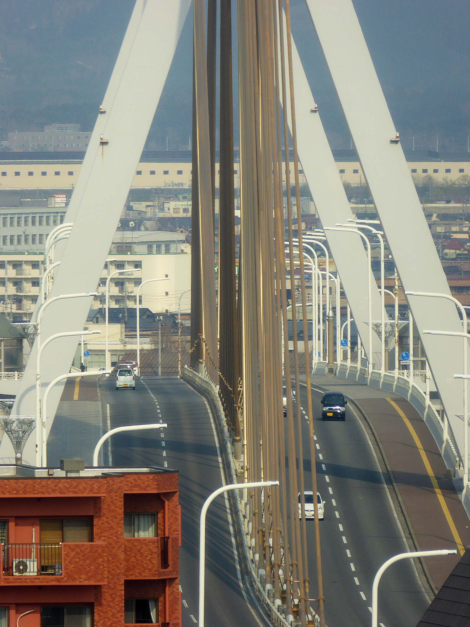
Aomori Bay Bridge
Little knownThe Aomori Bay Bridge (青森ベイブリッジ) is a 1.2-kilometer cable-stayed bridge spanning Aomori Harbor, completed in 1994 as par…
 Tomokazu Kitjaima / CC BY-SA 3.0
Tachineputa Matsuri
Little knownGoshogawara Tachineputa Matsuri (立佞武多, held August 4-8) is Aomori's second great summer festival, featuring the world's…
 ゆりのき橋 / CC BY 3.0
Jogakura Bridge
Little knownJogakura Bridge (城ヶ倉大橋) is a 360-meter-long arch bridge spanning Jogakura Gorge at a height of 122 meters, making it Jap…