
Nature
Mountains, rivers, forests, and natural wonders
538 spots
Japan's nature spots range from subarctic forest in Hokkaido to subtropical coastline in Okinawa, and the country's mountainous geography means dramatic scenery is rarely far from a train line — gorges, waterfalls, volcanic craters and cedar forests sit within day-trip range of most major cities. What distinguishes a Japanese nature spot from a generic viewpoint is usually the degree of care taken with access: a maintained boardwalk through a marsh, a funicular up a gorge, a designated photo point at a waterfall, because these places have been visited by hikers and pilgrims for centuries rather than discovered recently.
Before visiting, check the season deliberately rather than assuming year-round access. Many mountain trails and alpine routes close for snow between November and April or May; conversely, some of the country's best-known gorges and forests are built around a single autumn-foliage or fresh-green window a few weeks long. Bring cash for parking and small admission fees at prefectural and national parks, and expect mobile signal to drop away from the trailhead.
Nature spots concentrate most heavily in Hokkaido's national parks, the Japan Alps spanning Nagano, Gifu and Toyama, the volcanic belt running through Kyushu (Aso, Kirishima, Sakurajima), and the Tohoku region's beech forests and gorges. Coastal and island nature — sea cliffs, coral reefs, subtropical forest — is concentrated in Okinawa and the smaller islands off Kagoshima and Shizuoka.
Antes de ir
The thing to understand about nature in Japan is that almost none of it is wilderness in the sense of being unmanaged. A gorge has a boardwalk and a boat operator; a waterfall has a designated viewing platform and a bus that stops there; a marsh has a raised wooden path with passing places. This is the legacy of centuries of pilgrims and a century of domestic tourism, and it has two consequences worth planning around: access is far better than the terrain suggests, and the good spots are known, signposted and busy on the right weekend.
Most of it is free. Where there is a fee it is usually parking, a few hundred yen at a national or prefectural park, or a ropeway and a boat, which are the two things in this category that reliably cost real money — a couple of thousand yen return is normal for a cable car. Bring cash; rural car parks and small boat operators are not card operations.
Time it deliberately, because this is the category where "open" and "worth going" diverge most. Alpine routes and mountain park roads close for snow from around November until April or May, and a surprising number of the best-known gorges and forests are built around a single foliage or fresh-green window a few weeks long. A place that is spectacular in the third week of October is a car park in August.
Two safety notes that are boring and true: mobile signal drops away from the trailhead, and mountain weather changes faster than the forecast in the valley. Neither matters until it does.
Cómo elegir el primero
The useful first question is not which landscape you like but how much of the day you are prepared to give it. Nature spots fail visitors mostly through mismatch — three hours of travel for a viewpoint you look at for ten minutes, or a gorge walk started at four in the afternoon.
So choose by the shape of the visit first. If you have a spare half-day inside a city trip, take something with a fixed, contained mechanism — a boat through a gorge, a ropeway to a plateau, a marked circuit around a crater lake. These have a defined length, run to a timetable and cannot go wrong. If you have a whole day and a car, that is when the forest, the coastal road and the long valley become the better option, because they need slack in the schedule to be any good.
Second criterion: pick something in its season rather than something famous out of it. A second-tier waterfall in full autumn colour beats a first-tier one in bare November, and this category is unusually honest about that if you read the season on each entry.
Third, and specific to Japan: check what the last leg actually is. A great many of these sit at the end of a bus route with four services a day, and the difference between a good day and a stranded one is whether you read the return timetable before or after lunch. If the answer is "a car", accept that rather than trying to make trains work — this is the category where car access genuinely changes what is possible.
Errores frecuentes
Assuming a road or trail is open because the weather is fine. Mountain park roads and alpine traverses run to a calendar, not to conditions. Several of the best routes in the country are shut for half the year, reopen in April or May, and publish that date each spring.
Planning around the last bus in. The one that matters is the last bus out. Four services a day is common, the final one is often mid-afternoon, and taxis do not cruise past a trailhead.
Underestimating the walk from the car park. "Ten minutes" on a sign is ten minutes for someone who does it daily, and it is frequently down a slope you then have to come back up. Waterfall approaches in particular tend to be a staircase.
Going for foliage on the calendar rather than the report. Peak colour moves by altitude and by year, and a fortnight either side is the difference between the photograph and brown twigs. The same is true of blossom in reverse.
Turning up cashless. Parking, the ropeway kiosk, the boat and the mountain hut are cash. This catches people who have spent a week in Tokyo paying for everything by phone.
Treating a volcanic area as scenery. Sulphur valleys and crater rims have posted restrictions, gas warnings and closures that are about the gas rather than the view, and they change. Read the boards at the entrance rather than the one on the internet from last year.
Bringing city shoes. Boardwalks are wet, gorge paths are wet, moss is wet, and the stones by a waterfall are wet all the time regardless of the weather.
Within half an hour of a hub — nature without a whole day
124 lugares
Everything here sits close enough to an airport or a shinkansen station that it fits inside a day with other things in it. That is a real constraint on what nature can be, and this bundle is honest about it: expect gorges with boardwalks, ropeways to a viewpoint, city-edge forest and coastline you can reach on a local train. What you get in exchange is the ability to see something genuinely dramatic on a trip that was otherwise about cities, without a car, a hire desk or a night in a mountain town. Go early — proximity to a hub means the same thing for everyone else.
Yanagawa Canal Cruise
Little knownYanagawa, Fukuoka — about 15 km from Saga Station in a straight line. An hour or less on site, a few thousand yen.
Ogi City Hirado-bashi
Little knownOgi, Saga — about 7 km from Saga Station in a straight line. Half a day on site, free to enter. Worth timing for spring.
Kyuragi Valley
Little knownTakeo, Saga — about 7 km from Saga Station in a straight line. Half a day on site, free to enter.
Kase River Firefly Festival
Little knownSaga City, Saga — about 11 km from Saga Station in a straight line. Half a day on site, free to enter. Worth timing for summer.
Saga Riverine Plain
Little knownSaga City, Saga — about 10 km from Saga Station in a straight line. Half a day on site, free to enter. Worth timing for spring, autumn and winter.
Takasakiyama Monkey Park
Little knownUsa, Oita — about 8 km from Oita Station in a straight line. An hour or less on site, under ¥1,000.
Miyazaki Jingu
Little knownMiyazaki City, Miyazaki — about 3 km from Miyazaki Station in a straight line. An hour or less on site, under ¥1,000. Worth timing for spring.
Miyazaki City Phoenix Zoo
Little knownMiyazaki City, Miyazaki — about 4 km from Miyazaki Airport in a straight line. Half a day on site, under ¥1,000.
Yonaha Maehama Beach
Little knownMiyakojima, Okinawa — about 11 km from Miyako Airport in a straight line. A full day on site. Worth timing for spring and autumn.
Sunayama Beach
Little knownMiyakojima, Okinawa — about 10 km from Miyako Airport in a straight line. Half a day on site, free to enter.
Tennoji Zoo
Little knownTennoji, Osaka — about 6 km from Osaka Station in a straight line. Half a day on site, under ¥1,000.
Zuihoji Temple
Little knownArima Onsen, Hyogo — about 12 km from Shin-Kobe Station in a straight line. An hour or less on site, free to enter. Worth timing for autumn.
 Ilustración: no es una fotografía
Isonokami Jingu Shrine
Little knownTenri, Nara — about 4 km from Nara Station in a straight line. An hour or less on site.
Lake Biwa
Little knownOtsu, Shiga — about 0 km from Otsu Station in a straight line. Half a day on site, a few thousand yen.
 Ilustración: no es una fotografía
Lake Biwa Museum
Little knownOtsu, Shiga — about 13 km from Otsu Station in a straight line. Half a day on site, under ¥1,000.
 Ilustración: no es una fotografía
Wakayama Mikan & Umeboshi
Little knownWakayama City, Wakayama — about 6 km from Wakayama Station in a straight line. Half a day on site, under ¥1,000.
Kimii-dera Temple
Little knownWakayama City, Wakayama — about 4 km from Wakayama Station in a straight line. Half a day on site, under ¥1,000. Worth timing for spring and summer.
Kaga Onsen
Little knownKaga, Ishikawa — about 13 km from Komatsu Airport in a straight line. Half a day on site, under ¥1,000. Worth timing for autumn and winter.
Natadera Temple
Little knownKaga, Ishikawa — about 12 km from Komatsu Airport in a straight line. Half a day on site, under ¥1,000.
Togakushi Shrine
Little knownNagano City, Nagano — about 15 km from Nagano Station in a straight line. Half a day on site. Worth timing for spring and autumn.
Nihondaira Tea Plantations
Little knownShizuoka City, Shizuoka — about 6 km from Shizuoka Station in a straight line. Half a day on site, free to enter. Worth timing for spring.
Hamamatsu Sand Dunes
Little knownHamamatsu, Shizuoka — about 4 km from Hamamatsu Station in a straight line. Half a day on site, free to enter. Worth timing for summer and winter.
Sunpu Castle Park
Little knownShizuoka City, Shizuoka — about 1 km from Shizuoka Station in a straight line. Half a day on site. Worth timing for spring, autumn and winter.
Nagara River Cormorant Fishing (Ukai)
Little knownGifu City, Gifu — within half an hour of Gifu-Hashima Station. Half a day on site, a few thousand yen. Worth timing for spring, summer and autumn.
Niigata City Aquarium Marinepia
Little knownNiigata City, Niigata — about 5 km from Niigata Station in a straight line. Half a day on site, under ¥1,000.
Hakusan Shrine Furusato Village
Little knownNiigata City, Niigata — about 6 km from Niigata Station in a straight line. An hour or less on site, free to enter. Worth timing for summer.
Northern Culture Museum
Little knownNiigata City, Niigata — about 5 km from Niigata Station in a straight line. Half a day on site, under ¥1,000. Worth timing for spring, autumn and winter.
Toyama Bay Firefly Squid
Little knownToyama City, Toyama — about 14 km from Toyama Station in a straight line. Half a day on site, under ¥1,000. Worth timing for spring.
Toyama Castle & Matsukawa River Cruise
Little knownToyama City, Toyama — about 1 km from Toyama Station in a straight line. Half a day on site.
Toyama City Night View from Kureha Hills
Little knownToyama City, Toyama — about 4 km from Toyama Station in a straight line. Half a day on site. Worth timing for spring and winter.
Shosenkyo Gorge
Little knownKofu, Yamanashi — about 14 km from Kofu Station in a straight line. Half a day on site, a few thousand yen. Worth timing for spring, summer and autumn.
Maizuru Castle Park
Little knownKofu, Yamanashi — about 0 km from Kofu Station in a straight line. Half a day on site, under ¥1,000. Worth timing for spring and winter.
Yokokan Garden
Little knownFukui City, Fukui — about 1 km from Fukui Station in a straight line. An hour or less on site, under ¥1,000. Worth timing for spring, autumn and winter.
Omiya Bonsai Village
Little knownOmiya, Saitama — about 2 km from Omiya Station in a straight line. Half a day on site, under ¥1,000. Worth timing for spring and autumn.
 Ilustración: no es una fotografía
Musashi Ichinomiya Hikawa Shrine
Little knownSaitama City, Saitama — about 1 km from Omiya Station in a straight line. An hour or less on site. Worth timing for summer and winter.
Kibiji Cycling Road
Little knownOkayama City, Okayama — about 6 km from Okayama Station in a straight line. Half a day on site, under ¥1,000. Worth timing for spring, summer and autumn.
 Ilustración: no es una fotografía
Yuda Onsen
Little knownYamaguchi City, Yamaguchi — about 10 km from Shin-Yamaguchi Station in a straight line. Half a day on site, under ¥1,000.
Kannon-in Temple Garden
Little knownTottori City, Tottori — about 1 km from Tottori Station in a straight line. An hour or less on site, under ¥1,000.
Lake Shinji Sunset
Little knownMatsue, Shimane — about 7 km from Matsue Station in a straight line. An hour or less on site.
Yuushien Garden
Little knownMatsue, Shimane — about 5 km from Matsue Station in a straight line. Half a day on site, a few thousand yen. Worth timing for spring, autumn and winter.
Bizan Ropeway
Little knownTokushima City, Tokushima — about 1 km from Tokushima Station in a straight line. Half a day on site, a few thousand yen. Worth timing for spring, summer and winter.
Ryuga Cave
Little knownKami, Kochi — about 12 km from Kochi Airport in a straight line. Half a day on site, under ¥1,000.
Katsurahama Beach
Little knownKochi City, Kochi — about 7 km from Kochi Station in a straight line. Half a day on site, under ¥1,000. Worth timing for spring, autumn and winter.
Makino Botanical Garden
Little knownKochi City, Kochi — about 3 km from Kochi Station in a straight line. An hour or less on site, under ¥1,000. Worth timing for spring and autumn.
Aomori Bay Bridge
Little knownAomori City, Aomori — about 5 km from Shin-Aomori Station in a straight line. An hour or less on site, free to enter.
Koiwai Farm
Little knownHanamaki, Iwate — about 15 km from Morioka Station in a straight line. Half a day on site, under ¥1,000. Worth timing for spring, summer and autumn.
Senshu Park
Little knownAkita City, Akita — about 1 km from Akita Station in a straight line. Half a day on site, under ¥1,000.
Omoriyama Zoo
Little knownAkita City, Akita — about 8 km from Akita Station in a straight line. Half a day on site, free to enter. Worth timing for summer and winter.
Hanamiyama Park
Little knownFukushima City, Fukushima — about 2 km from Fukushima Station in a straight line.
Wakayama Farm Bamboo Grove
Little knownUtsunomiya, Tochigi — about 8 km from Utsunomiya Station in a straight line. Half a day on site, under ¥1,000.
Nokonoshima Island
Locally knownFukuoka City, Fukuoka — about 9 km from Hakata Station in a straight line. Half a day on site, under ¥1,000.
Fukuoka City Waterfront
Locally knownFukuoka City, Fukuoka — about 5 km from Hakata Station in a straight line. Half a day on site.
Uminonakamichi Seaside Park
Locally knownFukuoka City, Fukuoka — about 7 km from Fukuoka Airport in a straight line. Half a day on site, under ¥1,000. Worth timing for spring, summer and autumn.
Nakagawa River Walk
Locally knownFukuoka City, Fukuoka — about 2 km from Hakata Station in a straight line. An hour or less on site, free to enter.
Atago Shrine
Locally knownFukuoka City, Fukuoka — about 6 km from Hakata Station in a straight line. An hour or less on site, free to enter. Worth timing for spring, summer and autumn.
Nagasaki Ropeway Night View to Mt. Inasa
Locally knownNagasaki City, Nagasaki — about 3 km from Nagasaki Station in a straight line. Half a day on site, a few thousand yen.
Suizenji Jojuen Garden
Locally knownKumamoto City, Kumamoto — about 4 km from Kumamoto Station in a straight line. An hour or less on site, under ¥1,000. Worth timing for spring, autumn and winter.
Tatsuda-yama Park Cherry Blossoms
Locally knownKumamoto City, Kumamoto — about 4 km from Kumamoto Station in a straight line. An hour or less on site, free to enter. Worth timing for spring and winter.
Iso Beach
Locally knownKagoshima City, Kagoshima — about 6 km from Kagoshima-Chuo Station in a straight line. Half a day on site, free to enter.
Kagoshima City Aquarium
Locally knownKagoshima City, Kagoshima — about 3 km from Kagoshima-Chuo Station in a straight line. Half a day on site, under ¥1,000.
 Ilustración: no es una fotografía
Fukushu-en Garden
Locally knownNaha, Okinawa — about 1 km from Naha (Kencho-mae) in a straight line. An hour or less on site, under ¥1,000.
Kurama-dera Temple
Locally knownKyoto City, Kyoto — about 15 km from Kyoto Station in a straight line. Half a day on site, under ¥1,000. Worth timing for spring and autumn.
Shosei-en Garden
Locally knownKyoto City, Kyoto — about 0 km from Kyoto Station in a straight line. An hour or less on site, under ¥1,000.
 Ilustración: no es una fotografía
Eikan-do Temple
Locally knownKyoto City, Kyoto — about 4 km from Kyoto Station in a straight line. An hour or less on site, under ¥1,000.
Heian Shrine
Locally knownKyoto City, Kyoto — about 4 km from Kyoto Station in a straight line. An hour or less on site. Worth timing for spring, summer and autumn.
 Ilustración: no es una fotografía
Sento Imperial Palace
Locally knownKyoto City, Kyoto — about 4 km from Kyoto Station in a straight line. Half a day on site, free to enter. Worth timing for spring and autumn.
Nakanoshima
Locally knownOsaka City, Osaka — about 2 km from Osaka Station in a straight line. Half a day on site, under ¥1,000. Worth timing for spring and autumn.
Minoo Park
Locally knownOsaka City, Osaka — about 7 km from Itami Airport in a straight line. Half a day on site, free to enter. Worth timing for summer and autumn.
 Ilustración: no es una fotografía
Day Trip to Nara
Locally knownOsaka City, Osaka — about 1 km from Nara Station in a straight line. A full day on site.
Expo '70 Commemorative Park
Locally knownOsaka City, Osaka — about 9 km from Shin-Osaka Station in a straight line. Half a day on site, under ¥1,000. Worth timing for spring and autumn.
Osaka Bay Night Cruise
Locally knownOsaka City, Osaka — about 8 km from Osaka Station in a straight line. Half a day on site, a few thousand yen.
Spa World
Locally knownOsaka City, Osaka — about 6 km from Osaka Station in a straight line. Half a day on site, a few thousand yen.
Nunobiki Herb Garden & Ropeway
Locally knownKobe, Hyogo — about 1 km from Shin-Kobe Station in a straight line. Half a day on site, a few thousand yen. Worth timing for spring, summer and autumn.
Suma Beach
Locally knownKobe, Hyogo — about 11 km from Shin-Kobe Station in a straight line. Half a day on site, free to enter.
Wakakusayama Hill
Locally knownNara City, Nara — about 3 km from Nara Station in a straight line. Half a day on site, under ¥1,000. Worth timing for spring, autumn and winter.
Nomura Samurai House & Garden
Locally knownKanazawa, Ishikawa — about 2 km from Kanazawa Station in a straight line. An hour or less on site, under ¥1,000.
Utsukushigahara Open-Air Museum
Locally knownMatsumoto, Nagano — about 14 km from Matsumoto Station in a straight line. Half a day on site, under ¥1,000. Worth timing for summer and autumn.
Nagoya Castle Night Illumination
Locally knownNagoya, Aichi — about 2 km from Nagoya Station in a straight line. Half a day on site, under ¥1,000. Worth timing for spring, autumn and winter.
Atsuta Jingu Forest
Locally knownNagoya, Aichi — about 5 km from Nagoya Station in a straight line. An hour or less on site, free to enter.
Odori Park
Locally knownSapporo, Hokkaido — about 1 km from Sapporo Station in a straight line. An hour or less on site, under ¥1,000.
Goryokaku Star Fort
Locally knownHakodate, Hokkaido — about 4 km from Hakodate Station in a straight line. Half a day on site, under ¥1,000. Worth timing for spring and winter.
Sankeien Garden
Locally knownYokohama, Kanagawa — about 7 km from Yokohama Station in a straight line. Half a day on site, under ¥1,000. Worth timing for spring, autumn and winter.
Shukkei-en Garden
Locally knownHiroshima City, Hiroshima — about 1 km from Hiroshima Station in a straight line. An hour or less on site, under ¥1,000.
Sesshu Garden
Locally knownYamaguchi City, Yamaguchi — about 12 km from Shin-Yamaguchi Station in a straight line. An hour or less on site, under ¥1,000.
Yashima Temple & Historic Battlefield
Locally knownTakamatsu, Kagawa — about 4 km from Takamatsu Station in a straight line. Half a day on site, under ¥1,000. Worth timing for spring, autumn and winter.
Ehime Mikan
Locally knownMatsuyama, Ehime — about 0 km from Matsuyama Station in a straight line. An hour or less on site, under ¥1,000. Worth timing for spring, autumn and winter.
Nanrakuen Garden
Locally knownMatsuyama, Ehime — about 1 km from Matsuyama Station in a straight line. An hour or less on site, under ¥1,000.
Rinnoji Temple and Garden
Locally knownSendai, Miyagi — about 4 km from Sendai Station in a straight line. An hour or less on site, under ¥1,000.
Kamo no Ogusu
Locally knownAira, Kagoshima — about 14 km from Kagoshima Airport in a straight line. An hour or less on site, free to enter.
Negoroji (Takamatsu)
Locally knownTakamatsu, Kagawa — about 8 km from Takamatsu Station in a straight line. An hour or less on site, free to enter. Worth timing for spring and autumn.
Ohori Park
Well knownFukuoka City, Fukuoka — about 4 km from Hakata Station in a straight line. Half a day on site.
Mount Inasa Night View
Well knownNagasaki City, Nagasaki — about 3 km from Nagasaki Station in a straight line. Half a day on site.
Aoshima Island
Well knownMiyazaki City, Miyazaki — about 9 km from Miyazaki Airport in a straight line. Half a day on site, free to enter.
Sakurajima Active Volcano
Well knownSakurajima, Kagoshima — about 11 km from Kagoshima-Chuo Station in a straight line. Half a day on site, under ¥1,000.
Sengan-en Garden
Well knownKagoshima City, Kagoshima — about 6 km from Kagoshima-Chuo Station in a straight line. Half a day on site, under ¥1,000.
 Ilustración: no es una fotografía
Shiroyama Observatory
Well knownKagoshima City, Kagoshima — about 2 km from Kagoshima-Chuo Station in a straight line. An hour or less on site, free to enter. Worth timing for winter.
 Ilustración: no es una fotografía
Kabira Bay
Well knownIshigaki, Okinawa — about 13 km from Ishigaki Airport in a straight line. Half a day on site. Worth timing for spring and autumn.
Kamo River Noryo-yuka
Well knownKyoto City, Kyoto — about 3 km from Kyoto Station in a straight line. An hour or less on site, free to enter. Worth timing for spring and autumn.
Daitoku-ji Temple Complex
Well knownKyoto City, Kyoto — about 7 km from Kyoto Station in a straight line. Half a day on site.
Osaka Aquarium Kaiyukan
Well knownOsaka City, Osaka — about 8 km from Osaka Station in a straight line. Half a day on site, a few thousand yen.
Mt. Rokko Night View
Well knownKobe, Hyogo — about 8 km from Shin-Kobe Station in a straight line. Half a day on site, under ¥1,000.
Ukimido Pavilion
Well knownNara City, Nara — about 1 km from Nara Station in a straight line. An hour or less on site, free to enter.
Biei Patchwork Hills
Well knownBiei, Hokkaido — about 9 km from Asahikawa Airport in a straight line. Half a day on site, under ¥1,000. Worth timing for summer and autumn.
Yoyogi Park
Well knownShibuya, Tokyo — about 2 km from Shinjuku Station in a straight line. Half a day on site, free to enter.
Tottori Sand Dunes
Well knownTottori City, Tottori — about 5 km from Tottori Station in a straight line. Half a day on site.
 Pexels
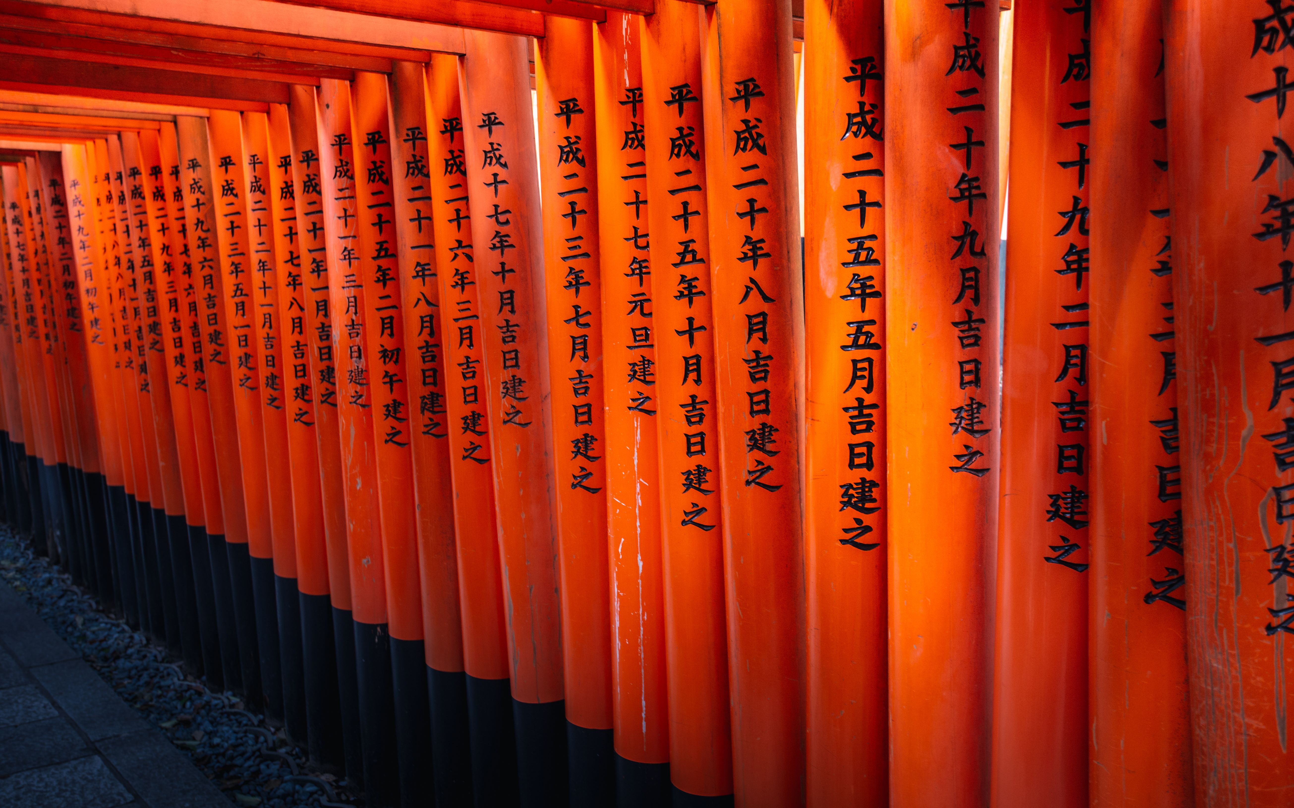
Fushimi Inari Taisha
FamousHigashiyama, Kyoto — within half an hour of Kyoto Station. An hour or less on site, free to enter.
 Unsplash
Arashiyama Bamboo Grove
FamousArashiyama, Kyoto — within half an hour of Kyoto Station. An hour or less on site, free to enter.
Kiyomizu-dera
FamousKyoto City, Kyoto — within half an hour of Kyoto Station. An hour or less on site, under ¥1,000.
Philosopher's Path
FamousKyoto City, Kyoto — about 5 km from Kyoto Station in a straight line. An hour or less on site, free to enter. Worth timing for spring, summer and autumn.
Ginkaku-ji Silver Pavilion
FamousKyoto City, Kyoto — about 6 km from Kyoto Station in a straight line. An hour or less on site, under ¥1,000. Worth timing for spring and autumn.
Ryoan-ji Rock Garden
FamousKyoto City, Kyoto — about 7 km from Kyoto Station in a straight line. An hour or less on site, under ¥1,000.
Tenryu-ji Temple
FamousArashiyama, Kyoto — about 8 km from Kyoto Station in a straight line. An hour or less on site, under ¥1,000.
Byodo-in Phoenix Hall
FamousUji, Kyoto — about 12 km from Kyoto Station in a straight line. An hour or less on site, under ¥1,000. Worth timing for spring and autumn.
Sagano Scenic Railway
FamousArashiyama, Kyoto — about 9 km from Kyoto Station in a straight line. An hour or less on site, under ¥1,000. Worth timing for spring and autumn.
Togetsukyo Bridge
FamousArashiyama, Kyoto — about 8 km from Kyoto Station in a straight line. An hour or less on site, free to enter. Worth timing for spring and autumn.
Tofuku-ji Temple
FamousKyoto City, Kyoto — about 2 km from Kyoto Station in a straight line. Half a day on site, under ¥1,000. Worth timing for spring and autumn.
Osaka Castle
FamousOsaka City, Osaka — within half an hour of Osaka Station. Half a day on site, under ¥1,000. Worth timing for spring and autumn.
 Ilustración: no es una fotografía
Nara Park Maple Viewing
FamousNara City, Nara — about 1 km from Nara Station in a straight line. Half a day on site. Worth timing for autumn and winter.
Kenrokuen Garden
FamousKanazawa, Ishikawa — about 2 km from Kanazawa Station in a straight line. Half a day on site, under ¥1,000. Worth timing for spring, autumn and winter.
Tokyo Metropolitan Building
FamousShinjuku, Tokyo — within half an hour of Shinjuku Station. Half a day on site, free to enter.
Ueno Park
FamousUeno, Tokyo — about 4 km from Tokyo Station in a straight line. Half a day on site.
 Ilustración: no es una fotografía
Tokyo Skytree
FamousShibuya, Tokyo — within half an hour of Tokyo Station. Half a day on site, a few thousand yen.
Korakuen Garden
FamousOkayama City, Okayama — about 2 km from Okayama Station in a straight line. Half a day on site, under ¥1,000.
Ritsurin Garden
FamousTakamatsu, Kagawa — about 2 km from Takamatsu Station in a straight line. Half a day on site, under ¥1,000. Worth timing for spring, autumn and winter.
Only worth it in the right weeks
257 lugares
These have a season and are frank about it. Fresh green, foliage, snow, a flower that runs for three weeks, water that only really moves after the melt. Outside the window they are pleasant and unremarkable; inside it they are the reason anyone comes. Read the season noted on each entry, then check a current report rather than a calendar, because peak dates shift by altitude and by year and are the single most common thing visitors get wrong here. If you are travelling outside the window, take one of the year-round entries instead rather than going anyway and being disappointed.
Mizuma Temple
Little knownKurume, Fukuoka — about 19 km from Saga Station in a straight line. Half a day on site, free to enter. Worth timing for autumn.
Itoshima Organic Farm Trail
Little knownItoshima, Fukuoka — about 18 km from Hakata Station in a straight line. Half a day on site, free to enter. Worth timing for spring and autumn.
Hamanoura Rice Terraces
Little knownSaga City, Saga — about 46 km from Saga Station in a straight line. Half a day on site, free to enter. Worth timing for spring.
Karatsu Sea Cave Kayaking
Little knownKaratsu, Saga — about 37 km from Saga Station in a straight line. Half a day on site, over ¥5,000. Worth timing for spring, summer and autumn.
Mifuneyama Rakuen
Little knownSaga City, Saga — about 27 km from Saga Station in a straight line. Half a day on site, under ¥1,000. Worth timing for spring, autumn and winter.
Higashimatsuura Peninsula Cycling Route
Little knownKaratsu, Saga — about 42 km from Saga Station in a straight line. A full day on site, free to enter. Worth timing for spring, summer and autumn.
Genkainada Sea Route
Little knownKaratsu, Saga — about 68 km from Hakata Station in a straight line. A full day on site, a few thousand yen. Worth timing for spring and autumn.
Hiratani Valley
Little knownUreshino, Saga — about 37 km from Saga Station in a straight line. Half a day on site, free to enter. Worth timing for spring, summer and autumn.
Karatsu Bay Sunset Fishing
Little knownKaratsu, Saga — about 37 km from Saga Station in a straight line. Half a day on site, a few thousand yen. Worth timing for summer and autumn.
Mifuneyama Autumn Maple Forest Walk
Little knownTakeo, Saga — about 27 km from Saga Station in a straight line. An hour or less on site, under ¥1,000. Worth timing for autumn.
Sefuri-san Mountain
Little knownSaga City, Saga — about 17 km from Fukuoka Airport in a straight line. A full day on site, free to enter. Worth timing for autumn and winter.
Kujukushima (99 Islands)
Little knownSasebo, Nagasaki — about 49 km from Nagasaki Station in a straight line. Half a day on site, over ¥5,000. Worth timing for spring, summer and autumn.
Fukue Island Beaches
Little knownGoto Islands, Nagasaki — about 96 km from Nagasaki Station in a straight line. A full day on site, free to enter. Worth timing for spring, summer and autumn.
Kumagawa River Rafting
Little knownHitoyoshi, Kumamoto — about 45 km from Kagoshima Airport in a straight line. Half a day on site, a few thousand yen. Worth timing for spring, summer and autumn.
Kikuchi Valley
Little knownKikuchi, Kumamoto — about 18 km from Kumamoto Airport in a straight line. Half a day on site, a few thousand yen. Worth timing for spring, summer and autumn.
Amakusa Five Bridges Sunset Drive
Little knownAmakusa, Kumamoto — about 33 km from Kumamoto Station in a straight line. Half a day on site, under ¥1,000. Worth timing for spring, autumn and winter.
Oka Castle Ruins
Little knownTaketa, Oita — about 35 km from Oita Station in a straight line. An hour or less on site, under ¥1,000. Worth timing for spring, autumn and winter.
Mt. Yufu Hiking
Little knownYufuin, Oita — about 23 km from Oita Station in a straight line. Half a day on site, free to enter. Worth timing for summer and autumn.
Harajiri Falls
Little knownBungo-ono, Oita — about 31 km from Oita Station in a straight line. An hour or less on site, free to enter. Worth timing for spring, summer and winter.
Cape Toi (Misaki Horses)
Little knownKushima, Miyazaki — about 53 km from Kagoshima-Chuo Station in a straight line. Half a day on site, free to enter. Worth timing for spring.
Amami Oshima
Little knownAmami Oshima, Kagoshima — within an hour of Naha (Kencho-mae). A full day on site, over ¥5,000. Worth timing for spring, summer and autumn.
 Ilustración: no es una fotografía
Kanoya Rose Garden
Little knownKanoya, Kagoshima — about 41 km from Kagoshima-Chuo Station in a straight line. Half a day on site, under ¥1,000. Worth timing for spring and autumn.
Naruto Whirlpools (Awaji side)
Little knownAwaji Island, Hyogo — about 20 km from Tokushima Station in a straight line. Half a day on site, a few thousand yen. Worth timing for spring and autumn.
Awaji Yumebutai
Little knownAwaji Island, Hyogo — about 32 km from Shin-Kobe Station in a straight line. Half a day on site, free to enter. Worth timing for spring, autumn and winter.
Awaji Farm Park England Hill
Little knownAwaji Island, Hyogo — about 30 km from Tokushima Station in a straight line. Half a day on site, under ¥1,000. Worth timing for spring, summer and autumn.
Akashi Castle Ruins & Sakura Park
Little knownAkashi, Hyogo — about 20 km from Shin-Kobe Station in a straight line. Half a day on site, free to enter. Worth timing for spring.
Genkyuen Garden
Little knownHikone, Shiga — about 40 km from Gifu-Hashima Station in a straight line. An hour or less on site, under ¥1,000. Worth timing for spring and autumn.
 Ilustración: no es una fotografía
Chikubushima Island
Little knownNagahama, Shiga — about 51 km from Gifu-Hashima Station in a straight line. Half a day on site, under ¥1,000. Worth timing for spring and autumn.
Biwako Valley
Little knownOtsu, Shiga — about 26 km from Otsu Station in a straight line. Half a day on site, a few thousand yen. Worth timing for spring, autumn and winter.
Hachiman-yama Ropeway & Panoramic Views
Little knownOmihachiman, Shiga — about 26 km from Otsu Station in a straight line. An hour or less on site, under ¥1,000. Worth timing for spring and autumn.
Lake Biwa Leisure Activities
Little knownOtsu, Shiga — about 24 km from Otsu Station in a straight line. Half a day on site, under ¥1,000. Worth timing for spring, summer and autumn.
Ishiyama-dera Temple
Little knownOtsu, Shiga — within an hour of Otsu Station. Half a day on site, under ¥1,000. Worth timing for spring, autumn and winter.
Takijiri-oji Shrine
Little knownTanabe, Wakayama — about 53 km from Wakayama Station in a straight line. An hour or less on site. Worth timing for spring and autumn.
Nabana no Sato
Little knownKuwana, Mie — about 23 km from Nagoya Station in a straight line. Half a day on site, under ¥1,000. Worth timing for winter.
Wakura Onsen
Little knownNanao, Ishikawa — within two hours of Toyama Station. A full day on site, over ¥5,000. Worth timing for spring, autumn and winter.
Noto Peninsula Coastal Drive
Little knownNoto, Ishikawa — about 83 km from Toyama Station in a straight line. A full day on site, under ¥1,000. Worth timing for spring, autumn and winter.
Hakuba Valley
Little knownHakuba, Nagano — about 33 km from Nagano Station in a straight line. Over ¥5,000. Worth timing for summer, autumn and winter.
Hotaka Mountain Range
Little knownKamikochi, Nagano — more than two hours of Matsumoto Station away. Worth timing for summer, autumn and winter.
Karuizawa Resort Town
Little knownKaruizawa, Nagano — about 37 km from Takasaki Station in a straight line. Half a day on site. Worth timing for summer and autumn.
 Ilustración: no es una fotografía
Shiraito Falls (Karuizawa)
Little knownKaruizawa, Nagano — about 42 km from Takasaki Station in a straight line. An hour or less on site, free to enter. Worth timing for spring, summer and autumn.
 Ilustración: no es una fotografía
Happo Pond
Little knownHakuba, Nagano — about 33 km from Nagano Station in a straight line. Half a day on site, a few thousand yen. Worth timing for summer and autumn.
Joren Falls
Little knownIzu, Shizuoka — about 52 km from Shizuoka Station in a straight line. An hour or less on site, under ¥1,000. Worth timing for spring and autumn.
Izu Kogen
Little knownIto, Shizuoka — about 65 km from Shizuoka Station in a straight line. A full day on site. Worth timing for winter.
Magome to Tsumago Hike
Little knownGifu City, Gifu — about 76 km from Nagoya Station in a straight line. Half a day on site. Worth timing for spring, autumn and winter.
Toki Forest Park
Little knownSado Island, Niigata — about 63 km from Niigata Station in a straight line. Half a day on site, under ¥1,000. Worth timing for spring and summer.
Hoshitoge Rice Terraces
Little knownTokamachi, Niigata — about 66 km from Nagano Station in a straight line. An hour or less on site, free to enter. Worth timing for spring, summer and autumn.
Kiyotsukyo Gorge Tunnel
Little knownEchigo-Yuzawa, Niigata — about 62 km from Nagano Station in a straight line. Half a day on site, under ¥1,000. Worth timing for autumn.
Koshihikari Rice
Little knownTainai, Niigata — about 35 km from Niigata Station in a straight line. A full day on site, a few thousand yen. Worth timing for autumn.
Senkaku Bay
Little knownSado Island, Niigata — about 79 km from Niigata Station in a straight line. Half a day on site, a few thousand yen. Worth timing for summer.
Gala Yuzawa Ski Resort
Little knownEchigo-Yuzawa, Niigata — about 65 km from Nagano Station in a straight line. A full day on site, a few thousand yen. Worth timing for spring and winter.
Kurobe Gorge Railway
Little knownKurobe, Toyama — about 34 km from Toyama Station in a straight line. Half a day on site, a few thousand yen. Worth timing for spring, summer and autumn.
 Ilustración: no es una fotografía
Lake Yamanakako
Little knownYamanakako, Yamanashi — about 38 km from Kofu Station in a straight line. Half a day on site, a few thousand yen. Worth timing for summer, autumn and winter.
Kawaguchiko Music Forest Museum
Little knownFujikawaguchiko, Yamanashi — about 23 km from Kofu Station in a straight line. Half a day on site, a few thousand yen. Worth timing for summer and autumn.
Lake Saiko Bat Cave and Forest
Little knownFujikawaguchiko, Yamanashi — about 22 km from Kofu Station in a straight line. Half a day on site, under ¥1,000. Worth timing for spring, autumn and winter.
Momiji Kairo Maple Corridor
Little knownFujikawaguchiko, Yamanashi — about 24 km from Kofu Station in a straight line. An hour or less on site, free to enter. Worth timing for autumn and winter.
Lake Shojiko and Lake Motosuko
Little knownFujikawaguchiko, Yamanashi — about 22 km from Kofu Station in a straight line. Half a day on site, under ¥1,000. Worth timing for spring, autumn and winter.
Wakasa Bay
Little knownObama, Fukui — about 56 km from Otsu Station in a straight line. A full day on site, under ¥1,000. Worth timing for spring, autumn and winter.
 Ilustración: no es una fotografía
Mount Hakusan White Mountain
Little knownKatsuyama, Fukui — about 42 km from Komatsu Airport in a straight line. A full day on site, under ¥1,000. Worth timing for summer and autumn.
Sotomo Crags
Little knownObama, Fukui — about 60 km from Otsu Station in a straight line. A full day on site, a few thousand yen. Worth timing for spring, summer and autumn.
Hitsujiyama Park Shibazakura
Little knownChichibu, Saitama — about 37 km from Takasaki Station in a straight line. Half a day on site, under ¥1,000. Worth timing for spring.
Nagatoro River Rafting
Little knownNagatoro, Saitama — about 27 km from Takasaki Station in a straight line. An hour or less on site, under ¥1,000. Worth timing for spring and autumn.
Hodosan Shrine & Ropeway
Little knownNagatoro, Saitama — about 27 km from Takasaki Station in a straight line. Half a day on site, under ¥1,000. Worth timing for spring, autumn and winter.
Mitsumine Shrine
Little knownChichibu, Saitama — about 42 km from Kofu Station in a straight line. Half a day on site, under ¥1,000. Worth timing for spring, summer and autumn.
Nagatoro Autumn Foliage
Little knownChichibu, Saitama — about 27 km from Takasaki Station in a straight line. Half a day on site, free to enter. Worth timing for autumn and winter.
Tenranzan Hiking
Little knownHanno, Saitama — about 28 km from Omiya Station in a straight line. Half a day on site, under ¥1,000. Worth timing for spring, autumn and winter.
Okinoshima Island
Little knownTateyama, Chiba — about 57 km from Yokohama Station in a straight line. Half a day on site, free to enter. Worth timing for spring, summer and autumn.
Nokogiriyama
Little knownTateyama, Chiba — about 38 km from Yokohama Station in a straight line. Half a day on site, a few thousand yen. Worth timing for spring, autumn and winter.
Taibusa Cape
Little knownKamogawa, Chiba — about 59 km from Yokohama Station in a straight line. Half a day on site, free to enter. Worth timing for spring, autumn and winter.
Mt. Haruna & Lake Haruna
Little knownTakasaki, Gunma — about 21 km from Takasaki Station in a straight line. Half a day on site. Worth timing for summer, autumn and winter.
 Ilustración: no es una fotografía
Akagi Shrine
Little knownTakasaki, Gunma — about 29 km from Takasaki Station in a straight line. Half a day on site. Worth timing for summer, autumn and winter.
Sandankyo Gorge
Little knownHatsukaichi, Hiroshima — about 32 km from Hiroshima Station in a straight line. Half a day on site, free to enter. Worth timing for spring, summer and autumn.
Tsuyama Castle Ruins
Little knownTsuyama, Okayama — about 46 km from Okayama Station in a straight line. An hour or less on site, under ¥1,000. Worth timing for spring, autumn and winter.
Kintaikyo Bridge
Little knownIwakuni, Yamaguchi — about 37 km from Hiroshima Station in a straight line. An hour or less on site, under ¥1,000. Worth timing for spring, summer and autumn.
Tsunoshima Bridge
Little knownShimonoseki, Yamaguchi — about 54 km from Shin-Yamaguchi Station in a straight line. Half a day on site, under ¥1,000. Worth timing for spring, summer and autumn.
Omijima Island
Little knownNagato, Yamaguchi — about 46 km from Shin-Yamaguchi Station in a straight line. Half a day on site, a few thousand yen. Worth timing for summer, autumn and winter.
Iwakuni Castle
Little knownIwakuni, Yamaguchi — about 37 km from Hiroshima Station in a straight line. Half a day on site, under ¥1,000. Worth timing for spring and winter.
Mt. Daisen
Little knownDaisen, Tottori — about 45 km from Matsue Station in a straight line. A full day on site. Worth timing for spring, summer and autumn.
Uradome Coast
Little knownTottori City, Tottori — about 18 km from Tottori Station in a straight line. Half a day on site, over ¥5,000. Worth timing for spring, summer and autumn.
Yonago Castle Ruins
Little knownYonago, Tottori — about 25 km from Matsue Station in a straight line. An hour or less on site, free to enter. Worth timing for spring, autumn and winter.
Angel Road (Shodoshima)
Little knownShodoshima, Kagawa — about 19 km from Takamatsu Station in a straight line. Half a day on site, free to enter. Worth timing for spring and autumn.
Chichibugahama Beach (Sunset Reflections)
Little knownMitoyo, Kagawa — about 39 km from Takamatsu Station in a straight line. Half a day on site, free to enter. Worth timing for spring and autumn.
Shodoshima Olive Park
Little knownShodoshima, Kagawa — about 23 km from Takamatsu Station in a straight line. Half a day on site, under ¥1,000. Worth timing for spring, summer and autumn.
 Ilustración: no es una fotografía
Kankakei Gorge
Little knownShodoshima, Kagawa — about 26 km from Takamatsu Station in a straight line. Half a day on site. Worth timing for spring, summer and autumn.
Shodoshima Monkey Park
Little knownShodoshima, Kagawa — about 26 km from Takamatsu Station in a straight line. Half a day on site, under ¥1,000. Worth timing for spring and winter.
Shimanami Kaido (Imabari side)
Little knownImabari, Ehime — more than two hours of Matsuyama Station away. A full day on site, a few thousand yen. Worth timing for spring, summer and autumn.
 Ilustración: no es una fotografía
Mount Ishizuchi
Little knownSaijo, Ehime — about 35 km from Matsuyama Station in a straight line. A full day on site, a few thousand yen. Worth timing for spring, summer and autumn.
Sada Misaki Peninsula
Little knownSaijo, Ehime — about 39 km from Oita Station in a straight line. Half a day on site, free to enter. Worth timing for spring, summer and autumn.
Bessho Onsen (Ehime)
Little knownSaijo, Ehime — about 33 km from Matsuyama Station in a straight line. A full day on site, under ¥1,000. Worth timing for spring, autumn and winter.
Oboke and Koboke Gorges
Little knownMiyoshi, Tokushima — about 42 km from Kochi Airport in a straight line. Half a day on site, a few thousand yen. Worth timing for spring and autumn.
 Ilustración: no es una fotografía
Mt. Tsurugi
Little knownMiyoshi, Tokushima — about 46 km from Tokushima Station in a straight line. Half a day on site, a few thousand yen. Worth timing for spring, summer and autumn.
Kazurabashi at Oku-Iya
Little knownIya Valley, Tokushima — about 36 km from Kochi Airport in a straight line. Half a day on site, under ¥1,000. Worth timing for spring and autumn.
Shimanto River
Little knownShimanto, Kochi — more than two hours of Kochi Station away. Half a day on site, a few thousand yen. Worth timing for spring, summer and autumn.
Niyodo River
Little knownNiyodogawa, Kochi — about 29 km from Kochi Station in a straight line. A full day on site, free to enter. Worth timing for spring, summer and autumn.
Aomori Apples
Little knownAomori City, Aomori — about 31 km from Shin-Aomori Station in a straight line. Half a day on site, under ¥1,000. Worth timing for autumn.
Hakkoda Mountains
Little knownAomori City, Aomori — about 24 km from Shin-Aomori Station in a straight line. Half a day on site, a few thousand yen. Worth timing for summer, autumn and winter.
Mount Osore
Little knownMutsu, Aomori — more than two hours of Hakodate Station away. Half a day on site, under ¥1,000. Worth timing for spring, summer and autumn.
Jogakura Bridge
Little knownTowada, Aomori — about 25 km from Shin-Aomori Station in a straight line. An hour or less on site, free to enter. Worth timing for spring and autumn.
Shimokita Peninsula
Little knownMutsu, Aomori — about 62 km from Hakodate Station in a straight line. A full day on site. Worth timing for spring, autumn and winter.
Tsugaru-Iwaki Skyline
Little knownHirosaki, Aomori — about 38 km from Shin-Aomori Station in a straight line. Half a day on site, a few thousand yen. Worth timing for spring, autumn and winter.
Jodogahama Beach
Little knownMiyako, Iwate — about 72 km from Morioka Station in a straight line. Half a day on site. Worth timing for spring, summer and autumn.
Mt. Iwate
Little knownHanamaki, Iwate — about 20 km from Morioka Station in a straight line. A full day on site. Worth timing for summer and autumn.
Sanriku Coast
Little knownKamaishi, Iwate — about 80 km from Morioka Station in a straight line. A full day on site. Worth timing for spring, summer and autumn.
 Ilustración: no es una fotografía
Miyagi Zao Ski Resort and Okama Crater
Little knownZao, Miyagi — about 16 km from Yamagata Station in a straight line. Half a day on site, under ¥1,000. Worth timing for spring, autumn and winter.
Lake Towada (Akita side)
Little knownSemboku, Akita — about 45 km from Shin-Aomori Station in a straight line. Half a day on site. Worth timing for summer and autumn.
Oga Peninsula
Little knownOga, Akita — about 48 km from Akita Station in a straight line. A full day on site, free to enter. Worth timing for summer and winter.
Dakigaeri Gorge
Little knownSemboku, Akita — about 41 km from Akita Station in a straight line. Half a day on site, free to enter. Worth timing for spring and autumn.
Hachimantai Plateau
Little knownSemboku, Akita — about 38 km from Morioka Station in a straight line. Half a day on site, under ¥1,000. Worth timing for spring, summer and autumn.
Mogami River Boat Ride
Little knownYamagata City, Yamagata — about 56 km from Yamagata Station in a straight line. An hour or less on site, a few thousand yen. Worth timing for spring, autumn and winter.
Tsuruga Castle
Little knownAizu-Wakamatsu, Fukushima — more than two hours of Koriyama Station away. Half a day on site, under ¥1,000. Worth timing for spring, autumn and winter.
Lake Inawashiro
Little knownKoriyama, Fukushima — about 26 km from Koriyama Station in a straight line. Half a day on site. Worth timing for spring, summer and autumn.
Goshiki-numa Ponds
Little knownKoriyama, Fukushima — about 37 km from Fukushima Station in a straight line. Half a day on site. Worth timing for spring and autumn.
Tadami Line
Little knownMinamiaizu, Fukushima — about 61 km from Niigata Station in a straight line. Half a day on site, a few thousand yen. Worth timing for spring, autumn and winter.
Okoshiki Coast
Little knownUto, Kumamoto — about 19 km from Kumamoto Station in a straight line. Half a day on site, free to enter. Worth timing for spring and winter.
Nabegataki Falls
Little knownOguni, Kumamoto — about 36 km from Kumamoto Airport in a straight line. An hour or less on site, under ¥1,000. Worth timing for spring and autumn.
Tashibu-no-Sho
Little knownBungotakada, Oita — about 32 km from Oita Station in a straight line. An hour or less on site, free to enter. Worth timing for spring, summer and autumn.
Ao no Domon
Little knownNakatsu, Oita — about 50 km from Oita Station in a straight line. An hour or less on site, free to enter. Worth timing for autumn.
Hitome Hakkei
Little knownNakatsu, Oita — about 44 km from Oita Station in a straight line. An hour or less on site, free to enter. Worth timing for spring and autumn.
Kokonoe Yume Suspension Bridge
Little knownKokonoe, Oita — about 36 km from Oita Station in a straight line. An hour or less on site, under ¥1,000. Worth timing for spring and autumn.
Tadewara Marsh
Little knownKokonoe, Oita — about 37 km from Oita Station in a straight line. Half a day on site, free to enter. Worth timing for spring, summer and autumn.
Himeshima
Little knownHimeshima, Oita — about 47 km from Shin-Yamaguchi Station in a straight line. Half a day on site, under ¥1,000. Worth timing for spring, summer and autumn.
Aya Teruha Suspension Bridge
Little knownAya, Miyazaki — about 19 km from Miyazaki Station in a straight line. Half a day on site, under ¥1,000. Worth timing for spring and autumn.
Ebino Kogen
Little knownEbino, Miyazaki — about 23 km from Kagoshima Airport in a straight line. Half a day on site, free to enter. Worth timing for spring, summer and autumn.
 Ilustración: no es una fotografía
Kunimigaoka
Little knownTakachiho, Miyazaki — about 41 km from Kumamoto Airport in a straight line. An hour or less on site, free to enter. Worth timing for autumn.
 Ilustración: no es una fotografía
Sogi Falls
Little knownIsa, Kagoshima — about 27 km from Kagoshima Airport in a straight line. Half a day on site, free to enter. Worth timing for summer and autumn.
Napoleon Rock
Little knownSatsumasendai, Kagoshima — about 80 km from Kagoshima-Chuo Station in a straight line. A full day on site. Worth timing for spring and autumn.
Lake Imuta
Little knownSatsumasendai, Kagoshima — about 22 km from Kagoshima Airport in a straight line. Half a day on site, free to enter. Worth timing for spring, summer and winter.
Makino Metasequoia Avenue
Little knownTakashima, Shiga — about 54 km from Otsu Station in a straight line. An hour or less on site, free to enter. Worth timing for spring, autumn and winter.
Samegai Baikamo
Little knownMaibara, Shiga — about 31 km from Gifu-Hashima Station in a straight line. An hour or less on site, free to enter. Worth timing for spring, summer and autumn.
Mount Ibuki
Little knownMaibara, Shiga — about 28 km from Gifu-Hashima Station in a straight line. Half a day on site, a few thousand yen. Worth timing for summer and autumn.
Eigenji
Little knownHigashiomi, Shiga — about 41 km from Gifu-Hashima Station in a straight line. Half a day on site, under ¥1,000. Worth timing for spring, summer and autumn.
Aragijima
Little knownAridagawa, Wakayama — about 28 km from Wakayama Station in a straight line. An hour or less on site, free to enter. Worth timing for spring and autumn.
Oishi Kogen
Little knownKimino, Wakayama — about 17 km from Wakayama Station in a straight line. Half a day on site, free to enter. Worth timing for autumn.
Dorokyo Gorge
Little knownShingu, Wakayama — about 77 km from Wakayama Station in a straight line. Half a day on site. Worth timing for spring and autumn.
Akame 48 Waterfalls
Little knownNabari, Mie — about 27 km from Nara Station in a straight line. Half a day on site, under ¥1,000. Worth timing for spring and autumn.
Maruyama Senmaida
Little knownKumano, Mie — about 81 km from Wakayama Station in a straight line. Half a day on site, free to enter. Worth timing for spring, summer and autumn.
Gozaisho Ropeway
Little knownKomono, Mie — about 33 km from Chubu Centrair Airport in a straight line. Half a day on site, a few thousand yen. Worth timing for autumn and winter.
Inabe Plum Grove
Little knownInabe, Mie — about 21 km from Gifu-Hashima Station in a straight line. Half a day on site, under ¥1,000. Worth timing for spring and winter.
Kamigare Tea Terraces
Little knownIbigawa, Gifu — about 25 km from Gifu-Hashima Station in a straight line. Half a day on site, free to enter. Worth timing for spring.
 Ilustración: no es una fotografía
Tokuyama Dam
Little knownIbigawa, Gifu — about 45 km from Gifu-Hashima Station in a straight line. Half a day on site, free to enter. Worth timing for spring and autumn.
Monet's Pond
Little knownSeki, Gifu — about 46 km from Gifu-Hashima Station in a straight line. An hour or less on site, free to enter. Worth timing for spring and autumn.
Tsukechi Gorge
Little knownNakatsugawa, Gifu — about 75 km from Nagoya Station in a straight line. Half a day on site, free to enter. Worth timing for summer and autumn.
Fukushimagata Lagoon
Little knownNiigata City, Niigata — about 16 km from Niigata Station in a straight line. Half a day on site, under ¥1,000. Worth timing for spring, summer and autumn.
Hyoko
Little knownAgano, Niigata — about 18 km from Niigata Station in a straight line. Half a day on site, free to enter. Worth timing for spring and autumn.
Nishikigoi no Sato
Little knownOjiya, Niigata — about 71 km from Niigata Station in a straight line. Half a day on site, under ¥1,000. Worth timing for autumn.
Yagigahana
Little knownSanjo, Niigata — about 42 km from Niigata Station in a straight line. An hour or less on site, free to enter. Worth timing for spring, summer and autumn.
Matsudai Nohbutai
Little knownTokamachi, Niigata — about 66 km from Nagano Station in a straight line. Half a day on site, a few thousand yen. Worth timing for spring, summer and autumn.
Naena Falls
Little knownMyoko, Niigata — about 24 km from Nagano Station in a straight line. An hour or less on site, free to enter. Worth timing for spring, summer and autumn.
Rainbow Line Summit Park
Little knownWakasa, Fukui — about 61 km from Fukui Station in a straight line. Half a day on site, under ¥1,000. Worth timing for spring, autumn and winter.
Ryusogataki Falls
Little knownIkeda, Fukui — about 21 km from Fukui Station in a straight line. An hour or less on site, free to enter. Worth timing for spring, summer and autumn.
Echizen Daffodils
Little knownEchizen Town, Fukui — about 24 km from Fukui Station in a straight line. Half a day on site, free to enter. Worth timing for winter.
Karikomi Pond
Little knownOno, Fukui — about 41 km from Fukui Station in a straight line. Half a day on site, free to enter. Worth timing for autumn.
Kinchakuda
Little knownHidaka, Saitama — about 28 km from Omiya Station in a straight line. Half a day on site, under ¥1,000. Worth timing for spring and autumn.
 Ilustración: no es una fotografía
Misotsuchi Icicles
Little knownChichibu, Saitama — about 43 km from Takasaki Station in a straight line. Half a day on site, under ¥1,000. Worth timing for winter.
Ogose Bairin
Little knownOgose, Saitama — about 33 km from Omiya Station in a straight line. Half a day on site, under ¥1,000. Worth timing for spring and winter.
Ranzan Gorge
Little knownRanzan, Saitama — about 31 km from Omiya Station in a straight line. Half a day on site, free to enter. Worth timing for summer, autumn and winter.
Kameiwa Cave
Little knownKimitsu, Chiba — about 47 km from Haneda Airport in a straight line. An hour or less on site, free to enter. Worth timing for spring and autumn.
Oyama Senmaida
Little knownKamogawa, Chiba — about 48 km from Yokohama Station in a straight line. Half a day on site, free to enter. Worth timing for spring, autumn and winter.
Awamata Falls
Little knownOtaki, Chiba — about 52 km from Haneda Airport in a straight line. Half a day on site, free to enter. Worth timing for spring, autumn and winter.
Shiramazu Flower Fields
Little knownMinamiboso, Chiba — about 67 km from Yokohama Station in a straight line. An hour or less on site. Worth timing for spring and winter.
Tsukimachi Falls
Little knownDaigo, Ibaraki — about 49 km from Mito Station in a straight line. An hour or less on site, free to enter. Worth timing for summer and autumn.
Hananuki Gorge
Little knownTakahagi, Ibaraki — about 43 km from Mito Station in a straight line. Half a day on site, free to enter. Worth timing for spring and autumn.
Ohirasan Shrine
Little knownTochigi, Tochigi — about 29 km from Utsunomiya Station in a straight line. Half a day on site, free to enter. Worth timing for spring, summer and autumn.
Momijidani Suspension Bridge
Little knownNasushiobara, Tochigi — about 44 km from Utsunomiya Station in a straight line. An hour or less on site, under ¥1,000. Worth timing for autumn and winter.
Sessho-seki
Little knownNasu, Tochigi — about 48 km from Koriyama Station in a straight line. An hour or less on site, free to enter. Worth timing for autumn and winter.
Takatsudo Gorge
Little knownMidori, Gunma — about 27 km from Takasaki Station in a straight line. An hour or less on site, free to enter. Worth timing for spring and autumn.
Lake Nozori
Little knownNakanojo, Gunma — about 41 km from Nagano Station in a straight line. Half a day on site, free to enter. Worth timing for summer and autumn.
Aisai no Oka
Little knownTsumagoi, Gunma — about 29 km from Nagano Station in a straight line. An hour or less on site, free to enter. Worth timing for summer and autumn.
Josei Falls
Little knownMiyoshi, Hiroshima — about 52 km from Hiroshima Airport in a straight line. An hour or less on site, free to enter. Worth timing for spring and autumn.
Taishakukyo Gorge
Little knownJinsekikogen, Hiroshima — about 39 km from Fukuyama Station in a straight line. Half a day on site, free to enter. Worth timing for spring, summer and autumn.
Imose Falls
Little knownHatsukaichi, Hiroshima — about 27 km from Hiroshima Station in a straight line. Half a day on site, free to enter. Worth timing for spring, summer and autumn.
Ametaki Falls
Little knownTottori City, Tottori — about 16 km from Tottori Station in a straight line. Half a day on site, free to enter. Worth timing for summer and autumn.
Tachikue Gorge
Little knownIzumo, Shimane — about 21 km from Izumo Airport in a straight line. Half a day on site, free to enter. Worth timing for spring and autumn.
 Ilustración: no es una fotografía
Ryuzugataki Falls
Little knownUnnan, Shimane — about 25 km from Izumo Airport in a straight line. An hour or less on site, free to enter. Worth timing for summer and autumn.
Ura-Hikimi Gorge
Little knownMasuda, Shimane — about 45 km from Hiroshima Station in a straight line. Half a day on site, free to enter. Worth timing for spring, summer and autumn.
Mikado Valley
Little knownManno, Kagawa — about 25 km from Takamatsu Station in a straight line. Half a day on site, free to enter. Worth timing for summer and autumn.
 Ilustración: no es una fotografía
Omogo Gorge
Little knownKumakogen, Ehime — about 34 km from Matsuyama Station in a straight line. Half a day on site, free to enter. Worth timing for spring, summer and autumn.
Nametoko Gorge
Little knownMatsuno, Ehime — about 72 km from Matsuyama Airport in a straight line. Half a day on site, free to enter. Worth timing for summer and autumn.
Nikobuchi
Little knownIno, Kochi — about 23 km from Kochi Station in a straight line. An hour or less on site, free to enter. Worth timing for summer and winter.
Nakatsu Gorge
Little knownNiyodogawa, Kochi — about 38 km from Kochi Station in a straight line. Half a day on site, free to enter. Worth timing for spring, summer and autumn.
Yasui Gorge
Little knownNiyodogawa, Kochi — about 36 km from Kochi Station in a straight line. Half a day on site, free to enter. Worth timing for spring, summer and autumn.
Befukyo Gorge
Little knownKami, Kochi — about 41 km from Kochi Airport in a straight line. Half a day on site, free to enter. Worth timing for summer and autumn.
Juniko Aoike
Little knownFukaura, Aomori — about 70 km from Shin-Aomori Station in a straight line. An hour or less on site, free to enter. Worth timing for spring and autumn.
Hachimantai Aspite Line
Little knownHachimantai, Iwate — about 29 km from Morioka Station in a straight line. Half a day on site, free to enter. Worth timing for spring, autumn and winter.
Goishi Coast
Little knownOfunato, Iwate — about 91 km from Morioka Station in a straight line. Half a day on site, free to enter. Worth timing for spring and autumn.
Hiraniwa Highland
Little knownKuji, Iwate — about 55 km from Morioka Station in a straight line. Half a day on site, free to enter. Worth timing for spring, summer and winter.
Michinoku Ajisai-en
Little knownIchinoseki, Iwate — about 82 km from Morioka Station in a straight line. Half a day on site, under ¥1,000. Worth timing for summer.
Katanuma
Little knownNaruko, Miyagi — about 55 km from Sendai Station in a straight line. Half a day on site, free to enter. Worth timing for summer and autumn.
Narukokyo Gorge
Little knownNaruko, Miyagi — about 54 km from Sendai Station in a straight line. Half a day on site, free to enter. Worth timing for autumn.
Izunuma and Uchinuma
Little knownKurihara, Miyagi — about 55 km from Sendai Station in a straight line. Half a day on site, free to enter. Worth timing for spring, summer and autumn.
Mototaki Fukuryusui
Little knownNikaho, Akita — about 64 km from Akita Station in a straight line. An hour or less on site, free to enter. Worth timing for spring and summer.
Goshogake Onsen
Little knownKazuno, Akita — about 51 km from Morioka Station in a straight line. Half a day on site, under ¥1,000. Worth timing for summer and autumn.
Jododaira
Little knownFukushima City, Fukushima — about 18 km from Fukushima Station in a straight line. Half a day on site, free to enter. Worth timing for spring, autumn and winter.
Beppu Ropeway to Mt. Tsurumi
Locally knownBeppu, Oita — about 16 km from Oita Station in a straight line. Half a day on site, a few thousand yen. Worth timing for autumn and winter.
Kifune Shrine
Locally knownKyoto City, Kyoto — about 15 km from Kyoto Station in a straight line. An hour or less on site. Worth timing for summer and winter.
Katsura Imperial Villa
Locally knownKyoto City, Kyoto — within an hour of Kyoto Station. An hour or less on site, under ¥1,000. Worth timing for spring and autumn.
Shoshazan Engyoji Temple
Locally knownHimeji, Hyogo — about 54 km from Shin-Kobe Station in a straight line. Half a day on site, under ¥1,000. Worth timing for spring, summer and autumn.
Himeji Central Park Safari
Locally knownHimeji, Hyogo — about 56 km from Shin-Kobe Station in a straight line. A full day on site, a few thousand yen. Worth timing for spring and autumn.
Meoto Iwa (Wedded Rocks)
Locally knownIse, Mie — about 41 km from Chubu Centrair Airport in a straight line. An hour or less on site, free to enter. Worth timing for spring and summer.
Bessho Onsen (Nagano)
Locally knownMatsumoto, Nagano — about 25 km from Matsumoto Station in a straight line. Half a day on site, under ¥1,000. Worth timing for autumn and winter.
Nagatoro Iwadatami Rock Shelf
Locally knownNagatoro, Saitama — about 27 km from Takasaki Station in a straight line. An hour or less on site, free to enter. Worth timing for summer and autumn.
Oze National Park
Locally knownKatashina, Gunma — more than two hours of Utsunomiya Station away. A full day on site. Worth timing for spring, summer and autumn.
Achi Shrine
Locally knownKurashiki, Okayama — about 15 km from Okayama Station in a straight line. An hour or less on site, free to enter. Worth timing for spring and autumn.
Akiu Great Falls (Akiu Otaki)
Locally knownSendai, Miyagi — about 18 km from Sendai Station in a straight line. An hour or less on site, free to enter. Worth timing for spring and autumn.
Michinoku Coastal Trail
Locally knownSendai, Miyagi — about 39 km from Sendai Station in a straight line. Half a day on site, free to enter. Worth timing for spring, summer and autumn.
Izumi Crane Observation Centre
Locally knownIzumi, Kagoshima — about 53 km from Kagoshima Airport in a straight line. Half a day on site, under ¥1,000. Worth timing for autumn and winter.
Kongorinji
Locally knownAisho, Shiga — about 41 km from Gifu-Hashima Station in a straight line. Half a day on site, under ¥1,000. Worth timing for autumn.
Hirayu Great Falls
Locally knownTakayama, Gifu — about 37 km from Matsumoto Station in a straight line. Half a day on site, free to enter. Worth timing for summer and winter.
 Ilustración: no es una fotografía
Shomyo Falls
Locally knownTateyama, Toyama — about 31 km from Toyama Station in a straight line. Half a day on site, free to enter. Worth timing for spring, summer and autumn.
Sugisawa no Sawasugi
Locally knownNyuzen, Toyama — about 36 km from Toyama Station in a straight line. An hour or less on site, free to enter. Worth timing for spring, summer and autumn.
Ryuokyo Gorge
Locally knownNikko, Tochigi — about 37 km from Utsunomiya Station in a straight line. An hour or less on site, free to enter. Worth timing for spring and autumn.
Kirifuri Falls
Locally knownNikko, Tochigi — about 35 km from Utsunomiya Station in a straight line. An hour or less on site, free to enter. Worth timing for summer and autumn.
Chatsubomigoke Park
Locally knownNakanojo, Gunma — about 36 km from Nagano Station in a straight line. Half a day on site, under ¥1,000. Worth timing for spring and autumn.
Oni no Shitaburui
Locally knownOkuizumo, Shimane — about 30 km from Izumo Airport in a straight line. Half a day on site, free to enter. Worth timing for spring and autumn.
Hotokegaura
Locally knownSai, Aomori — about 53 km from Hakodate Station in a straight line. Half a day on site, free to enter. Worth timing for spring and autumn.
Rairaikyo Gorge
Locally knownSendai, Miyagi — about 17 km from Sendai Station in a straight line. An hour or less on site, free to enter. Worth timing for spring and autumn.
To-no-Hetsuri
Locally knownShimogo, Fukushima — about 47 km from Koriyama Station in a straight line. An hour or less on site, free to enter. Worth timing for spring and autumn.
Shiraito Falls (Itoshima)
Well knownItoshima, Fukuoka — about 18 km from Hakata Station in a straight line. Half a day on site, free to enter. Worth timing for summer and autumn.
Keya Otehon Sea Cave
Well knownFukuoka City, Fukuoka — about 23 km from Hakata Station in a straight line. Half a day on site, free to enter. Worth timing for spring, summer and autumn.
Yufuin
Well knownYufuin, Oita — about 23 km from Oita Station in a straight line. Half a day on site, under ¥1,000. Worth timing for spring, autumn and winter.
Kinrinko Lake
Well knownYufuin, Oita — about 22 km from Oita Station in a straight line. An hour or less on site, free to enter. Worth timing for spring and autumn.
Kirishima Shrine
Well knownKirishima, Kagoshima — about 16 km from Kagoshima Airport in a straight line. Half a day on site, free to enter. Worth timing for spring and autumn.
Ebino Kogen Plateau
Well knownKirishima, Kagoshima — about 18 km from Kagoshima Airport in a straight line. Half a day on site, under ¥1,000. Worth timing for spring and autumn.
 Ilustración: no es una fotografía
Chiran Tea Fields
Well knownChiran, Kagoshima — about 26 km from Kagoshima-Chuo Station in a straight line. Half a day on site, under ¥1,000. Worth timing for spring and autumn.
Nakijin Castle Ruins
Well knownNago, Okinawa — about 59 km from Naha (Kencho-mae) in a straight line. An hour or less on site, under ¥1,000. Worth timing for spring, autumn and winter.
Kokoen Garden
Well knownHimeji, Hyogo — about 49 km from Shin-Kobe Station in a straight line. An hour or less on site, under ¥1,000. Worth timing for spring and autumn.
Mount Yoshino
Well knownYoshino, Nara — within two hours of Nara Station. Half a day on site, under ¥1,000. Worth timing for spring and autumn.
Yoshino Mikumari Shrine
Well knownYoshino, Nara — about 35 km from Nara Station in a straight line. An hour or less on site, free to enter. Worth timing for spring and autumn.
Kumano Kodo Pilgrimage Trails
Well knownTanabe, Wakayama — more than two hours of Wakayama Station away. A full day on site. Worth timing for spring, summer and autumn.
Kumano Kodo Iseji Route
Well knownIga, Mie — about 76 km from Nara Station in a straight line. Half a day on site. Worth timing for spring, summer and autumn.
Daio Wasabi Farm
Well knownMatsumoto, Nagano — about 19 km from Matsumoto Station in a straight line. Half a day on site, free to enter. Worth timing for spring and autumn.
Tateyama Kurobe Alpine Route (Nagano side)
Well knownHakuba, Nagano — about 37 km from Toyama Station in a straight line. A full day on site, over ¥5,000. Worth timing for spring, autumn and winter.
Shiraito Falls (Fujinomiya)
Well knownFujinomiya, Shizuoka — about 39 km from Kofu Station in a straight line. An hour or less on site, free to enter. Worth timing for spring, summer and winter.
 Ilustración: no es una fotografía
Kadowaki Suspension Bridge
Well knownIto, Shizuoka — about 66 km from Shizuoka Station in a straight line. An hour or less on site, free to enter. Worth timing for winter.
Gokayama Ainokura
Well knownShirakawa-go, Gifu — about 30 km from Kanazawa Station in a straight line. Half a day on site. Worth timing for spring, autumn and winter.
Shiretoko Peninsula
Well knownShiretoko, Hokkaido — more than two hours of Asahikawa Airport away. Half a day on site, under ¥1,000. Worth timing for summer, autumn and winter.
Yuigahama Beach
Well knownKamakura, Kanagawa — about 19 km from Yokohama Station in a straight line. Half a day on site, free to enter. Worth timing for summer, autumn and winter.
Oki Islands
Well knownOki Islands, Shimane — about 86 km from Matsue Station in a straight line. A few thousand yen. Worth timing for spring, summer and autumn.
Iya Valley Vine Bridges
Well knownIya Valley, Tokushima — within two hours of Kochi Airport. Half a day on site, under ¥1,000. Worth timing for spring and autumn.
Oirase Gorge
Well knownTowada, Aomori — more than two hours of Shin-Aomori Station away. Half a day on site, free to enter. Worth timing for spring, summer and autumn.
Lake Towada (Aomori side)
Well knownTowada, Aomori — about 43 km from Shin-Aomori Station in a straight line. Half a day on site, free to enter. Worth timing for summer and autumn.
Shirakami-Sanchi
Well knownAomori — about 59 km from Shin-Aomori Station in a straight line. Half a day on site, free to enter. Worth timing for spring, summer and autumn.
Aoni Onsen
Well knownMutsu, Aomori — about 33 km from Shin-Aomori Station in a straight line. A full day on site, over ¥5,000. Worth timing for spring, autumn and winter.
Matsushima Bay Scenic Cruise
Well knownMatsushima, Miyagi — within an hour of Sendai Station. Half a day on site, a few thousand yen. Worth timing for spring and autumn.
Zao Fox Village (Miyagi Zao Kitsune Mura)
Well knownZao, Miyagi — within two hours of Fukushima Station. Half a day on site, under ¥1,000. Worth timing for spring, autumn and winter.
Kakunodate Samurai District
Well knownKakunodate, Akita — more than two hours of Akita Station away. Half a day on site. Worth timing for spring, autumn and winter.
Lake Tazawa
Well knownSemboku, Akita — about 41 km from Morioka Station in a straight line. Half a day on site, under ¥1,000. Worth timing for summer and autumn.
Nyuto Onsen
Well knownSemboku, Akita — about 36 km from Morioka Station in a straight line. Half a day on site, under ¥1,000. Worth timing for autumn and winter.
Yakushima Ancient Cedar Forest
FamousYakushima, Kagoshima — more than two hours of Kagoshima-Chuo Station away. A full day on site, under ¥1,000. Worth timing for spring, summer and autumn.
 Pexels
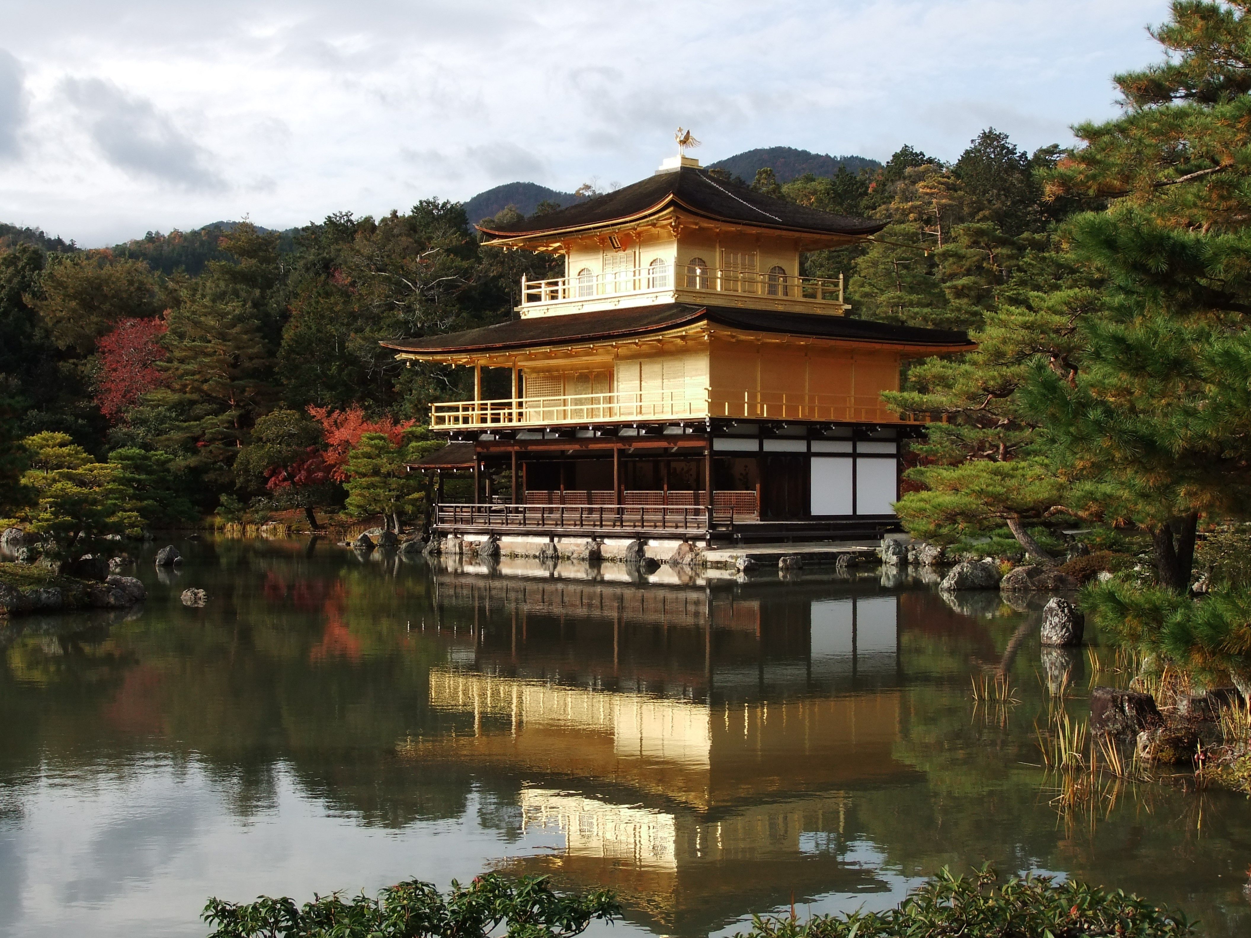
Kinkaku-ji Golden Pavilion
FamousKyoto City, Kyoto — within an hour of Kyoto Station. An hour or less on site, under ¥1,000. Worth timing for spring, autumn and winter.
Mt. Fuji
FamousFujinomiya, Shizuoka — more than two hours of Kofu Station away. A full day on site, a few thousand yen. Worth timing for summer, autumn and winter.
Chureito Pagoda
FamousFujikawaguchiko, Yamanashi — within two hours of Kofu Station. Half a day on site, free to enter. Worth timing for spring and autumn.
Lake Kawaguchiko
FamousFujikawaguchiko, Yamanashi — within two hours of Kofu Station. A full day on site, free to enter. Worth timing for spring, autumn and winter.
 Ilustración: no es una fotografía
Mt. Fuji Yoshida Trail
FamousFujiyoshida, Yamanashi — within two hours of Kofu Station. A full day on site, a few thousand yen. Worth timing for summer and autumn.
Furano Lavender Fields
FamousFurano, Hokkaido — about 30 km from Asahikawa Airport in a straight line. Half a day on site, free to enter. Worth timing for summer.
Naoshima Contemporary Art Island
FamousNaoshima, Kagawa — more than two hours of Takamatsu Station away. A full day on site, under ¥1,000. Worth timing for spring and autumn.
Hirosaki Castle
FamousHirosaki, Aomori — about 31 km from Shin-Aomori Station in a straight line. Half a day on site. Worth timing for spring and winter.
Zao Snow Monsters (Juhyo)
FamousZao, Yamagata — more than two hours of Yamagata Station away. Half a day on site, a few thousand yen. Worth timing for spring and winter.
Car country — the deep valleys and long coasts
93 lugares
Two hours or more from a hub, or somewhere the timetable simply does not go. This is the part of the category that most rewards giving up on trains: forest roads, capes, plateaus, valleys with one bus a day and a village at the end of them. Budget the whole day, fill the tank before you leave the main road, and check seasonal closures — a great many of these routes are shut by snow from late autumn to spring, and the reopening date is published rather than guessed. Mobile signal will drop. Download the map before you go rather than after you have lost it.
Amago Falls
Little knownAsakura, Fukuoka — about 29 km from Fukuoka Airport in a straight line. Half a day on site, free to enter.
Niji-no-Matsubara
Little knownKaratsu, Saga — about 41 km from Saga Station in a straight line. Half a day on site, free to enter.
Nijinomatsubara Seaside Cycling
Little knownKaratsu, Saga — about 41 km from Saga Station in a straight line. Half a day on site, free to enter.
Omi Shrine
Little knownHyuga, Miyazaki — about 69 km from Miyazaki Station in a straight line. An hour or less on site, free to enter.
Takachiho Amaterasu Railway
Little knownNobeoka, Miyazaki — about 45 km from Kumamoto Airport in a straight line. An hour or less on site, a few thousand yen.
Amanohashidate
Little knownMiyazu, Kyoto — about 83 km from Kyoto Station in a straight line. Half a day on site, under ¥1,000.
Shirahama White Beach Resort
Little knownShirahama, Wakayama — about 63 km from Wakayama Station in a straight line. Half a day on site.
Senjojiki & Sandanbeki Cliffs
Little knownShirahama, Wakayama — about 65 km from Wakayama Station in a straight line. An hour or less on site.
Kumano Hongu Taisha
Little knownTanabe, Wakayama — about 69 km from Wakayama Station in a straight line. An hour or less on site.
Engetsu Island
Little knownShirahama, Wakayama — about 62 km from Wakayama Station in a straight line. An hour or less on site, free to enter.
Toba Aquarium
Little knownToba, Mie — about 42 km from Chubu Centrair Airport in a straight line. Half a day on site, a few thousand yen.
 Ilustración: no es una fotografía
Ago Bay
Little knownShima, Mie — about 60 km from Chubu Centrair Airport in a straight line. Half a day on site.
Matsusaka Castle Ruins & Former Merchant District
Little knownMatsusaka, Mie — about 41 km from Chubu Centrair Airport in a straight line.
Kashikojima Island
Little knownShima, Mie — about 60 km from Chubu Centrair Airport in a straight line.
Notojima Aquarium
Little knownNanao, Ishikawa — about 52 km from Toyama Station in a straight line. Half a day on site, under ¥1,000.
Mitsukejima Rock
Little knownSuzu, Ishikawa — about 85 km from Toyama Station in a straight line. An hour or less on site, free to enter.
 Ilustración: no es una fotografía
Shibu Onsen
Little knownYamanouchi, Nagano — more than two hours of Nagano Station away. A full day on site, under ¥1,000.
Shimoda Beaches
Little knownShimoda, Shizuoka — about 61 km from Shizuoka Station in a straight line. A full day on site, free to enter.
Izu Wasabi Farms
Little knownIzu, Shizuoka — about 52 km from Shizuoka Station in a straight line. An hour or less on site, under ¥1,000.
Gero Onsen
Little knownGero, Gifu — about 74 km from Gifu-Hashima Station in a straight line. Half a day on site, free to enter.
Gujo Hachiman
Little knownGujo, Gifu — about 54 km from Gifu-Hashima Station in a straight line. Half a day on site.
Gero Onsen Gassho Village
Little knownGero, Gifu — about 75 km from Gifu-Hashima Station in a straight line. Half a day on site, under ¥1,000.
Kurobe Dam
Little knownKurobe, Toyama — about 43 km from Toyama Station in a straight line. Half a day on site.
Kushiro Shitsugen
Little knownKushiro, Hokkaido — about 166 km from Asahikawa Airport in a straight line. Half a day on site, under ¥1,000.
Lake Akan
Little knownAkan, Hokkaido — about 135 km from Asahikawa Airport in a straight line. Half a day on site, a few thousand yen.
 Ilustración: no es una fotografía
Inubosaki Lighthouse
Little knownChoshi, Chiba — about 44 km from Narita Airport in a straight line. Half a day on site, under ¥1,000.
Tateyama Flower Fields
Little knownTateyama, Chiba — about 60 km from Yokohama Station in a straight line. Half a day on site, free to enter.
Motonosumi Inari Shrine
Little knownNagato, Yamaguchi — about 49 km from Shin-Yamaguchi Station in a straight line. An hour or less on site, free to enter.
Hinoyama Park
Little knownShimonoseki, Yamaguchi — about 42 km from Shin-Yamaguchi Station in a straight line. Half a day on site, under ¥1,000.
 Ilustración: no es una fotografía
Tawarayama Onsen
Little knownNagato, Yamaguchi — about 49 km from Shin-Yamaguchi Station in a straight line. Half a day on site, under ¥1,000.
Kanmon Pedestrian Tunnel
Little knownShimonoseki, Yamaguchi — about 46 km from Shin-Yamaguchi Station in a straight line. An hour or less on site, under ¥1,000.
Kotohira-gu Shrine (Konpira-san)
Little knownKotohira, Kagawa — more than two hours of Takamatsu Station away. Half a day on site.
 Ilustración: no es una fotografía
Iya Onsen Cliff Bath
Little knownIya Valley, Tokushima — within two hours of Kochi Airport. Half a day on site, a few thousand yen.
Takegashima Hot Spring
Little knownAnan, Tokushima — about 50 km from Tokushima Station in a straight line. Half a day on site, under ¥1,000.
Ashizuri Cape
Little knownTosashimizu, Kochi — about 105 km from Kochi Station in a straight line. A full day on site, a few thousand yen.
Genbikei Gorge
Little knownIchinoseki, Iwate — about 78 km from Sendai Station in a straight line. Half a day on site.
Oga Aquarium GAO
Little knownOga, Akita — about 37 km from Akita Station in a straight line. Half a day on site, under ¥1,000.
Gassan Ski Resort
Little knownZao, Yamagata — about 43 km from Yamagata Station in a straight line.
Aquamarine Fukushima
Little knownIwaki, Fukushima — about 68 km from Koriyama Station in a straight line.
Ikeyama Spring
Little knownUbuyama, Kumamoto — about 38 km from Kumamoto Airport in a straight line. An hour or less on site, free to enter.
Daikanbo
Little knownAso, Kumamoto — about 28 km from Kumamoto Airport in a straight line. An hour or less on site, free to enter.
Kyusendo Cave
Little knownKumamura, Kumamoto — about 54 km from Kagoshima Airport in a straight line. Half a day on site.
Inazumi Underwater Cave
Little knownBungo-ono, Oita — about 38 km from Oita Station in a straight line. Half a day on site, a few thousand yen.
Umagase
Little knownHyuga, Miyazaki — about 61 km from Miyazaki Station in a straight line. Half a day on site, free to enter.
Ogawa Falls
Little knownMinamiosumi, Kagoshima — about 48 km from Kagoshima-Chuo Station in a straight line. Half a day on site, under ¥1,000.
Cape Sata
Little knownMinamiosumi, Kagoshima — about 58 km from Kagoshima-Chuo Station in a straight line. Half a day on site, free to enter.
Bise Fukugi Tree Road
Little knownMotobu, Okinawa — about 58 km from Naha (Kencho-mae) in a straight line. Half a day on site, free to enter.
Daisekirinzan
Little knownKunigami, Okinawa — about 91 km from Naha (Kencho-mae) in a straight line. Half a day on site, a few thousand yen.
Kafu Banta
Little knownUruma, Okinawa — about 35 km from Naha (Kencho-mae) in a straight line. An hour or less on site, free to enter.
Harie Shozu no Sato
Little knownTakashima, Shiga — about 43 km from Otsu Station in a straight line. Half a day on site, under ¥1,000.
Lake Yogo
Little knownNagahama, Shiga — about 51 km from Gifu-Hashima Station in a straight line. Half a day on site, free to enter.
Shirasaki Marine Park
Little knownYura, Wakayama — about 31 km from Wakayama Station in a straight line. Half a day on site, free to enter.
Fossa Magna Museum
Little knownItoigawa, Niigata — about 51 km from Nagano Station in a straight line. Half a day on site, under ¥1,000.
Sasagawa Nagare
Little knownMurakami, Niigata — about 64 km from Niigata Station in a straight line. Half a day on site, free to enter.
Hisui Coast
Little knownAsahi, Toyama — about 45 km from Toyama Station in a straight line. Half a day on site, free to enter.
Sankyoson Viewpoint
Little knownTonami, Toyama — about 21 km from Toyama Station in a straight line. An hour or less on site, free to enter.
Uriwari Falls
Little knownWakasa, Fukui — about 51 km from Otsu Station in a straight line. An hour or less on site, free to enter.
Hiruzen Highlands
Little knownManiwa, Okayama — about 54 km from Matsue Station in a straight line. Half a day on site, free to enter.
Ikura Cave
Little knownNiimi, Okayama — about 48 km from Okayama Station in a straight line. An hour or less on site, under ¥1,000.
Makido Cave
Little knownNiimi, Okayama — about 47 km from Okayama Station in a straight line. An hour or less on site, under ¥1,000.
Yusu Mizugaura Terraced Fields
Little knownUwajima, Ehime — about 74 km from Matsuyama Airport in a straight line. An hour or less on site, free to enter.
Tatsukushi Coast
Little knownTosashimizu, Kochi — about 106 km from Kochi Station in a straight line. Half a day on site.
Yokogurayama Museum
Little knownOchi, Kochi — about 28 km from Kochi Station in a straight line. An hour or less on site, under ¥1,000.
Tanesashi Coast
Little knownHachinohe, Aomori — about 83 km from Shin-Aomori Station in a straight line. Half a day on site, free to enter.
Mt. Hakodate Night View
Locally knownHakodate, Hokkaido — more than two hours of Hakodate Station away. Half a day on site, a few thousand yen.
Old Tokaido Road
Locally knownHakone, Kanagawa — about 62 km from Yokohama Station in a straight line. An hour or less on site, free to enter.
Mt. Misen
Locally knownMiyajima, Hiroshima — within two hours of Hiroshima Station. Half a day on site, under ¥1,000.
 Ilustración: no es una fotografía
Ryusendo Cave
Locally knownMiyako, Iwate — more than two hours of Morioka Station away. An hour or less on site, a few thousand yen.
Gesashi Mangrove Forest
Locally knownHigashi, Okinawa — about 64 km from Naha (Kencho-mae) in a straight line. An hour or less on site, free to enter.
Hashigui-iwa
Locally knownKushimoto, Wakayama — about 100 km from Wakayama Station in a straight line. An hour or less on site, free to enter.
Byobugaura
Locally knownChoshi, Chiba — about 41 km from Narita Airport in a straight line. Half a day on site, free to enter.
Tainoura
Locally knownKamogawa, Chiba — about 61 km from Haneda Airport in a straight line. Half a day on site, a few thousand yen.
Fujido Cave
Locally knownUeno Village, Gunma — about 35 km from Takasaki Station in a straight line. An hour or less on site, under ¥1,000.
Iwami Tatamigaura
Locally knownHamada, Shimane — about 69 km from Hiroshima Station in a straight line. Half a day on site, free to enter.
Takachiho Gorge
Well knownTakachiho, Miyazaki — about 45 km from Kumamoto Airport in a straight line. Half a day on site, under ¥1,000.
Udo Jingu Shrine
Well knownNichinan, Miyazaki — about 40 km from Miyazaki Airport in a straight line. An hour or less on site, free to enter.
Amano Yasukawara Cave
Well knownTakachiho, Miyazaki — about 40 km from Kumamoto Airport in a straight line. An hour or less on site, free to enter.
Lake Ikeda
Well knownIbusuki, Kagoshima — about 44 km from Kagoshima-Chuo Station in a straight line. Half a day on site, under ¥1,000.
Blue Cave
Well knownOnna, Okinawa — about 40 km from Naha (Kencho-mae) in a straight line. Half a day on site, a few thousand yen.
Churaumi Aquarium
Well knownNago, Okinawa — more than two hours of Naha (Kencho-mae) away. Half a day on site, a few thousand yen.
 Ilustración: no es una fotografía
Miyama Kayabuki Village
Well knownMiyama, Kyoto — within two hours of Kyoto Station. Half a day on site.
Senmaida Rice Terraces
Well knownWajima, Ishikawa — about 86 km from Toyama Station in a straight line. Half a day on site, free to enter.
Kamikochi Valley
Well knownKamikochi, Nagano — more than two hours of Matsumoto Station away. Half a day on site.
Hida Furukawa
Well knownHida Furukawa, Gifu — about 52 km from Toyama Station in a straight line. Half a day on site.
Muroto Cape
Well knownMuroto, Kochi — about 56 km from Kochi Airport in a straight line. A full day on site, free to enter.
Geibikei Gorge
Well knownIchinoseki, Iwate — about 81 km from Sendai Station in a straight line. Half a day on site, a few thousand yen.
Takkoku no Iwaya Bishamon-do
Well knownHiraizumi, Iwate — about 81 km from Sendai Station in a straight line. Half a day on site, under ¥1,000.
Onigajo
Well knownKumano, Mie — about 92 km from Nara Station in a straight line. Half a day on site, free to enter.
 Ilustración: no es una fotografía
Tadami
Well knownTadami, Fukushima — about 67 km from Niigata Station in a straight line. Half a day on site, free to enter.
Nachi Falls & Kumano Nachi Taisha
FamousNachikatsuura, Wakayama — about 90 km from Wakayama Station in a straight line. Half a day on site.
Lake Ashi
FamousHakone, Kanagawa — more than two hours of Yokohama Station away. Half a day on site, a few thousand yen.
Owakudani Valley
FamousHakone, Kanagawa — about 60 km from Yokohama Station in a straight line. An hour or less on site.
Adachi Museum of Art
FamousYasugi, Shimane — more than two hours of Matsue Station away. Half a day on site, a few thousand yen.
Open any time — the reliable fallbacks
64 lugares
The entries with no season attached and no long journey: places that look much the same whenever you turn up, which makes them the right answer on a day when the weather has ruined the plan or you have three unexpected hours. Nothing here needs to be timed, booked or built around, and most of it is free. That is not a criticism — a category dominated by narrow windows and long drives needs somewhere to send a reader who has neither a car nor the right fortnight, and these are the entries that will not waste the trip.
Raizan Sennyoji Temple
Little knownItoshima, Fukuoka — about 18 km from Hakata Station in a straight line. Half a day on site, free to enter.
Maruo Falls
Little knownKirishima, Kagoshima — about 15 km from Kagoshima Airport in a straight line. An hour or less on site, free to enter.
Taketomi Island
Little knownTaketomi, Okinawa — within an hour of Ishigaki Airport. A full day on site, under ¥1,000.
Yonaha-Oke Cape Park
Little knownMiyakojima, Okinawa — about 17 km from Miyako Airport in a straight line. Half a day on site.
 Ilustración: no es una fotografía
Manta Ray Snorkeling
Little knownIshigaki, Okinawa — within an hour of Ishigaki Airport. Half a day on site, over ¥5,000.
Shirahige Shrine
Little knownOtsu, Shiga — about 32 km from Otsu Station in a straight line. An hour or less on site, free to enter.
Nagahama Castle & Lake Biwa Lakeside Park
Little knownNagahama, Shiga — about 38 km from Gifu-Hashima Station in a straight line. An hour or less on site, under ¥1,000.
Chirihama Nagisa Driveway
Little knownHakui, Ishikawa — about 36 km from Kanazawa Station in a straight line. An hour or less on site, free to enter.
Nozawa Onsen
Little knownNozawa Onsen, Nagano — about 38 km from Nagano Station in a straight line. A full day on site, under ¥1,000.
Gifu Castle
Little knownGifu City, Gifu — about 16 km from Gifu-Hashima Station in a straight line. Half a day on site, under ¥1,000.
Amaharashi Coast
Little knownTakaoka, Toyama — about 21 km from Toyama Station in a straight line. An hour or less on site, free to enter.
Oshino Hakkai
Little knownFujikawaguchiko, Yamanashi — about 34 km from Kofu Station in a straight line. Half a day on site, under ¥1,000.
Tojinbo Cliffs
Little knownSakai, Fukui — about 21 km from Fukui Station in a straight line. Half a day on site, a few thousand yen.
Shonan Beach
Little knownShonan, Kanagawa — about 21 km from Yokohama Station in a straight line. A full day on site, free to enter.
Katori Shrine
Little knownSawara, Chiba — about 18 km from Narita Airport in a straight line. Half a day on site, free to enter.
Shimanami Kaido (Onomichi side)
Little knownOnomichi, Hiroshima — within an hour of Fukuyama Station. A few thousand yen.
Bitchu Matsuyama Castle
Little knownTakahashi, Okayama — within an hour of Okayama Station. An hour or less on site, under ¥1,000.
Akiyoshido Cave
Little knownMine, Yamaguchi — about 17 km from Shin-Yamaguchi Station in a straight line. An hour or less on site, under ¥1,000.
Akiyoshidai Plateau
Little knownMine, Yamaguchi — about 17 km from Shin-Yamaguchi Station in a straight line. An hour or less on site, under ¥1,000.
Kikko Park
Little knownIwakuni, Yamaguchi — about 37 km from Hiroshima Station in a straight line. Half a day on site, under ¥1,000.
Hagi Castle Ruins
Little knownHagi, Yamaguchi — about 36 km from Shin-Yamaguchi Station in a straight line. Half a day on site, under ¥1,000.
Hinomisaki Shrine & Lighthouse
Little knownIzumo, Shimane — about 24 km from Izumo Airport in a straight line. Half a day on site.
 Ilustración: no es una fotografía
Naruto Whirlpools (Tokushima side)
Little knownNaruto, Tokushima — within an hour of Tokushima Station. Half a day on site, under ¥1,000.
Yakuoji Temple
Little knownAnan, Tokushima — about 18 km from Tokushima Station in a straight line. An hour or less on site, under ¥1,000.
Abukuma Cave
Little knownIwaki, Fukushima — about 30 km from Koriyama Station in a straight line. An hour or less on site, a few thousand yen.
Lake Hibara
Little knownKoriyama, Fukushima — about 37 km from Fukushima Station in a straight line.
Shirakawa Spring
Little knownMinamiaso, Kumamoto — about 23 km from Kumamoto Airport in a straight line. An hour or less on site, under ¥1,000.
Kamishikimi Kumanoimasu Shrine
Little knownTakamori, Kumamoto — about 28 km from Kumamoto Airport in a straight line. Half a day on site, free to enter.
Kudaka Island
Little knownNanjo, Okinawa — about 22 km from Naha (Kencho-mae) in a straight line. Half a day on site.
Okishima
Little knownOmihachiman, Shiga — about 28 km from Otsu Station in a straight line. Half a day on site, under ¥1,000.
Yoshimi Hyakuana
Little knownYoshimi, Saitama — about 23 km from Omiya Station in a straight line. Half a day on site, under ¥1,000.
Gongendo Embankment
Little knownSatte, Saitama — about 22 km from Omiya Station in a straight line. Half a day on site, free to enter.
 Ilustración: no es una fotografía
Ushimado Olive Garden
Little knownSetouchi, Okayama — about 23 km from Okayama Station in a straight line. Half a day on site, free to enter.
Kitagishima Stone Quarry Lookout
Little knownKasaoka, Okayama — about 20 km from Fukuyama Station in a straight line. A full day on site, under ¥1,000.
Sanbe Azukihara Buried Forest
Little knownOda, Shimane — about 37 km from Izumo Airport in a straight line. Half a day on site, under ¥1,000.
Takeo Shrine 3,000-Year-Old Camphor Tree
Locally knownTakeo, Saga — about 27 km from Saga Station in a straight line. An hour or less on site, free to enter.
Kamado Jigoku
Locally knownBeppu, Oita — about 16 km from Oita Station in a straight line. An hour or less on site, under ¥1,000.
Shinhotaka Ropeway
Locally knownTakayama, Gifu — about 29 km from Matsumoto Station in a straight line. Half a day on site, a few thousand yen.
Pola Museum of Art
Locally knownHakone, Kanagawa — within an hour of Yokohama Station. Half a day on site, a few thousand yen.
Hokokuji Temple
Locally knownKamakura, Kanagawa — about 18 km from Yokohama Station in a straight line. An hour or less on site, under ¥1,000.
Garyu Sanso Villa
Locally knownOzu, Ehime — about 38 km from Matsuyama Airport in a straight line. An hour or less on site, under ¥1,000.
Mt. Bandai
Locally knownKoriyama, Fukushima — about 35 km from Koriyama Station in a straight line. A full day on site.
Uozu Buried Forest Museum
Locally knownUozu, Toyama — about 21 km from Toyama Station in a straight line. Half a day on site, under ¥1,000.
Kanmangafuchi Abyss
Locally knownNikko, Tochigi — about 35 km from Utsunomiya Station in a straight line. An hour or less on site, free to enter.
Mount Washu
Locally knownKurashiki, Okayama — about 24 km from Takamatsu Station in a straight line. Half a day on site, free to enter.
Sakurai Futamigaura
Well knownItoshima, Fukuoka — about 22 km from Hakata Station in a straight line. An hour or less on site, free to enter.
Unzen Jigoku (Unzen Hell)
Well knownUnzen, Nagasaki — about 37 km from Nagasaki Station in a straight line. An hour or less on site, free to enter.
Shimabara Spring Water Swimming Carp Streets
Well knownShimabara, Nagasaki — about 30 km from Kumamoto Station in a straight line. An hour or less on site, free to enter.
Mt. Aso Nakadake Crater
Well knownAso, Kumamoto — about 22 km from Kumamoto Airport in a straight line. Half a day on site, under ¥1,000.
Amakusa Islands
Well knownAmakusa, Kumamoto — about 35 km from Nagasaki Station in a straight line. A full day on site, a few thousand yen.
 Ilustración: no es una fotografía
Sun Messe Nichinan
Well knownNichinan, Miyazaki — about 39 km from Miyazaki Airport in a straight line. An hour or less on site, under ¥1,000.
Chiran Samurai Gardens
Well knownChiran, Kagoshima — about 25 km from Kagoshima-Chuo Station in a straight line. Half a day on site, under ¥1,000.
Jigokudani Snow Monkey Park
Well knownYamanouchi, Nagano — about 26 km from Nagano Station in a straight line. Half a day on site, under ¥1,000.
Yudanaka Onsen
Well knownYamanouchi, Nagano — about 24 km from Nagano Station in a straight line. Half a day on site, under ¥1,000.
Tateyama Kurobe Alpine Route (Toyama side)
Well knownTateyama, Toyama — within an hour of Toyama Station. A full day on site, over ¥5,000.
Aokigahara Forest
Well knownFujikawaguchiko, Yamanashi — about 24 km from Kofu Station in a straight line. An hour or less on site, under ¥1,000.
Hasedera Temple
Well knownKamakura, Kanagawa — about 19 km from Yokohama Station in a straight line. Half a day on site, under ¥1,000.
Enoshima Island
Well knownEnoshima, Kanagawa — about 23 km from Yokohama Station in a straight line. Half a day on site.
Beppu Jigoku Meguri (Hell Tour)
FamousBeppu, Oita — about 16 km from Oita Station in a straight line. Half a day on site, under ¥1,000.
Nara Park
FamousNara City, Nara — within an hour of Nara Station. Half a day on site, free to enter.
Shirakawa-go Gassho-zukuri Village
FamousShirakawa-go, Gifu — within an hour of Kanazawa Station. Half a day on site.
 Ilustración: no es una fotografía
Hakone Shrine
FamousHakone, Kanagawa — within an hour of Yokohama Station. An hour or less on site, free to enter.
Itsukushima Shrine
FamousMiyajima, Hiroshima — within an hour of Hiroshima Station. Half a day on site, under ¥1,000.
Miyajima Island
FamousMiyajima, Hiroshima — about 18 km from Hiroshima Station in a straight line. A full day on site.